More than 40,000 people have been ordered to evacuate their homes across New South Wales and 18,000 are on alert as the state braces for another day of devastation.
Overnight, land slips threatened homes, hundreds of cars became trapped on flooded roads and evacuation orders were issued as floodwaters continued to rise across Sydney's northern and western suburbs, the Hunter Valley and Kempsey.
Flood levels in parts of the NSW capital are expected to reach new highs not seen since March 1978, with more than 65 evacuation orders now in place.
Evacuation centres were established to help those with nowhere else to go, including at Mona Vale and Freshwater Surf Club on the Northern Beaches, and Penrith RSL in Sydney's west.
After intense rainfall led to flash flooding across Sydney's northern beaches yesterday, the Bureau of Meteorology now warns damaging winds could lash a 600km stretch of the NSW coastline.
A severe weather warning was updated this morning, with winds of up to 90km/h expected from the Mid North Coast to the South Coast.
Molineux Pt recorded a 111km/h wind gust late last night, and Sydney Airport also had an intense 94km/h gust at 9.20pm.
"The State Emergency Service advises that people should move vehicles under cover or away from trees, secure or put away loose items around your house, yard and balcony and keep at least eight metres away from fallen power lines or objects that may be energised, such as fences," the bureau warned.
SES spokeswoman Andrea Cantle was concerned the strong winds could further complicate Sydney's weather, with trees potentially falling because of overly saturated soil.
Cantle urged the community to be "as careful as possible", adding that the SES is "asking people to avoid the road".
"With properties, put away any loose items, bring your pets indoors because it's going to get quite windy, the rain may die down and the wind will pick up," she said.
A separate severe weather warning for hazardous surf has been issued across the Hunter Coast, Sydney Coast, Illawarra Coast, Batemans Coast and Eden Coast.
The "adverse weather conditions" have closed a large number of schools across NSW.
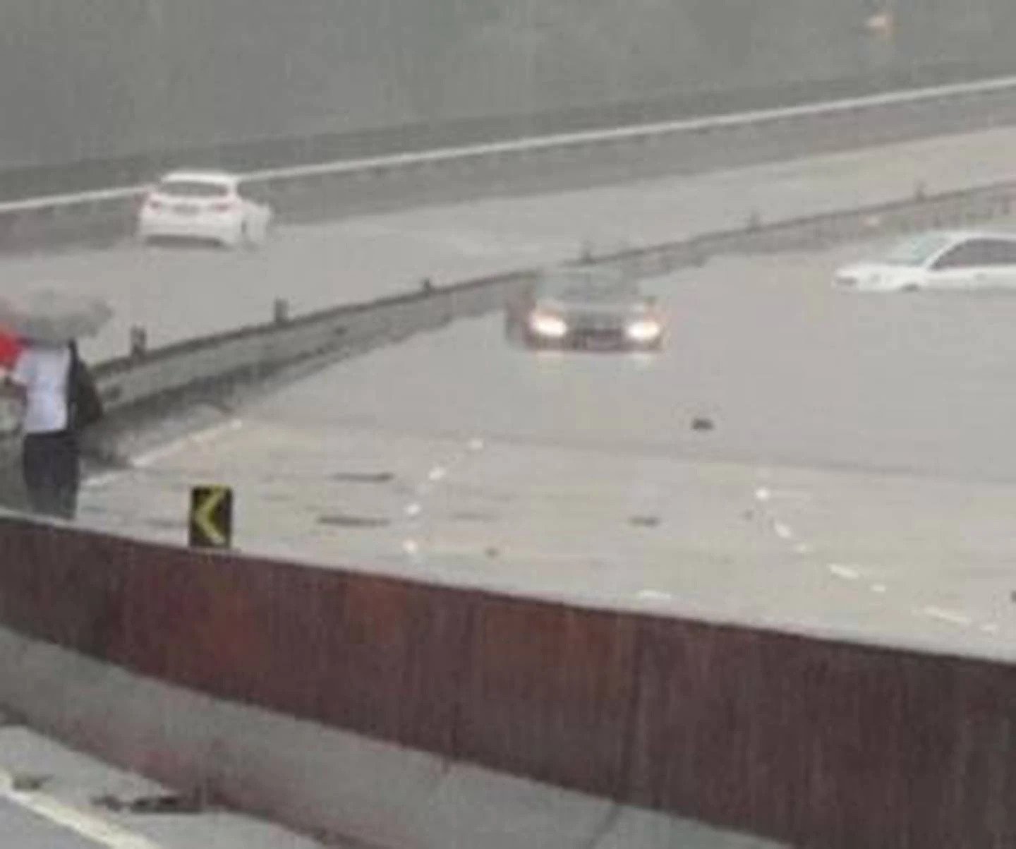
Cars attempting to cross floodwaters on the Roseville Bridge were left stranded. Photo / Facebook
Further north, the SES directed residents along the Hunter River within Glenridding Dunolly and Combo to evacuate "high danger areas".
The rising Hawkesbury – predicted to peak at Windsor at noon on Wednesday – also threatened homes at McGraths Hill and Mulgrave. "Once floodwater reaches 13.5 metres at Windsor, the area will be isolated," the SES said.
Reprieve from the rain is forecast for tomorrow, but Bureau of Meteorology senior meteorologist Dean Narramore warned that more rainfall in already soaked catchments is likely – and dangerous.
"Even though the sun does come out, we are likely to see many of these rivers continuing to experience major flooding," Narramore said.
"And for some, the flood peak won't occur until Wednesday or Thursday."
The Hawkesbury and Nepean Rivers remain of most concern, with Narramore saying both were in danger of floods "equal to or greater than what we saw in March of 2021".

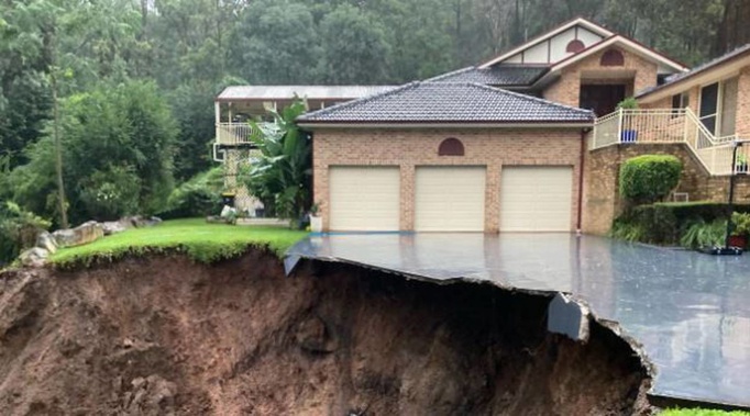
A photo from social media of what's believed to be from a landslip at a house in Emu Heights. Photo / Twitter
Western Sydney residents out of homes for another week
It's unlikely that some residents in Sydney's west forced to flee their homes last week will be able to return for at least another seven days, the SES has said.
Spokesman Phil Campbell said that water levels at the Hawkesbury River had topped last year's flood in many locations, adding that warnings would remain in place for the likes of North Richmond and Windsor for some time.
"In western Sydney we're looking at flooding levels higher than last year, meaning that people that have been evacuated near McGraths Hill and Windsor, who sadly have been evacuated out there for close to a week, it looks like it'll be close to a week before they can go back," he said.
"These floods waters go up very quickly and take so long to drain out – it's described as a bathtub effect.
"We're going to continue to see high water levels and it won't be until later today that the Hawkesbury will peak. It's already peaked in North Richmond but it'll likely peak around noon today in Windsor.
"We're looking at rivers that go up really fast but slowly creep up and down again."
Warning of 'extreme' public transport delays
Transport for NSW has again advised people to avoid the rail network after yesterday's conditions wrought havoc on the system with flooding, landslips and fallen trees on tracks.
"Severe weather conditions are affecting the network with significant disruptions and larger than normal service gaps," the department said.
"Please avoid any non-essential travel, and if you have to travel please plan ahead and leave plenty of extra travel time."
Speaking to 2GB radio on Wednesday morning, NSW Transport Minister David Elliott urged all commuters to "rethink" whether they needed to travel and warned of "extreme" delays.
"There will be further delays today. We've got forecasts of 100km/h of winds expected," Elliott said.
"A lot of the system is going to be affected today. My message to listeners is, given these delays, you might get more productivity working from home."
- by Natalie Brown, news.com.au
Take your Radio, Podcasts and Music with you


