Residents of several suburbs in and around Sydney were told to leave their homes overnight as a monster storm bears down on the city, with predictions as much as half a metre of rain could fall in total.
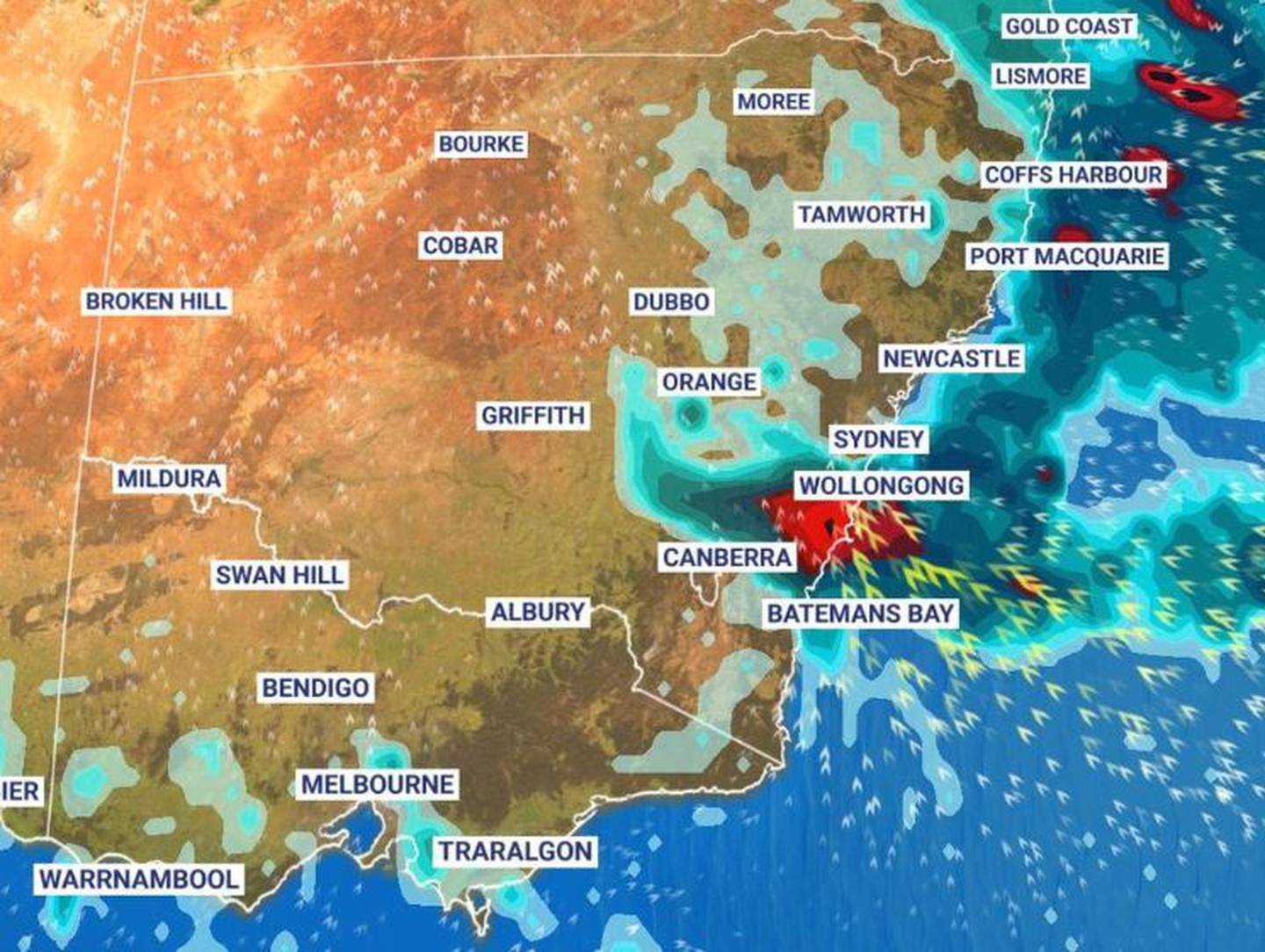
Forecasters have said the worst of the weather is yet to come with an East Coast Low set to near the coast on Sunday and drag into Monday.
The outlook is now for the East Coast Low to have multiple centres to it which could turbocharge its impact.
"There are numerous threats," said Sky News Weather senior meteorologist Tom Saunders.
"There's torrential rain, the risk of major flooding, landslides as well as damaging winds which could bring down trees and lead to property damage and power outrages".

Forecasters have warned an East Coast Low could hit on Sunday. Photo / Sky News Weather
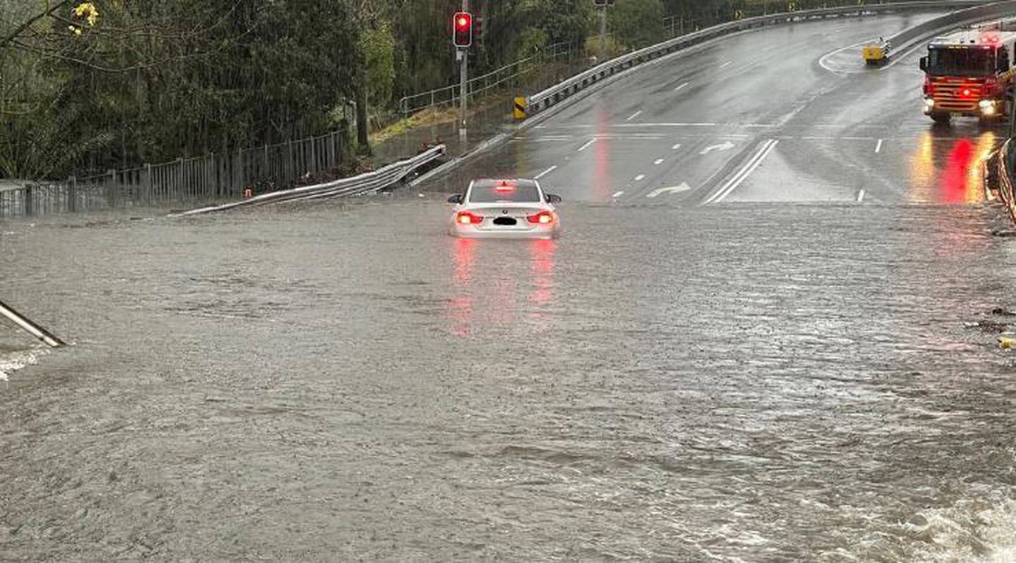
Authorities have pleaded with motorists not to drive through flooded roads – one of the leading causes of deaths following extreme rain events.
Overnight, the State Emergency Service issued a number of an emergency evacuations or prepare to evacuate notices across the west, southwest and southern Sydney.
Suburbs in danger of flooding include Wallacia, Camden, Lansvale, Woronora as well as areas of the Liverpool local government area. Parts of Richmond, in the city's northwest, are also on notice.
That's due to rain pouring into the already swollen Hawkesbury and Nepean rivers on Sydney's fringe.
SES: 'You may be trapped'
Many suburbs are in danger of being completely cut off, the SES said early on Sunday.
"You may be trapped without power, water and other essential services and it may be too dangerous to rescue you," the organisation warned.
Emergency evacuation centres have been set up in Narellan and Canley Vale.
Rainfall totals around Sydney and the Illawarra region have been immense.
Lucas Heights, in the city's south, bettered that with 215mm. Areas near Wollongong have seen almost 170mm and 150mm fell in the Southern Highlands.
The system is currently off the coast but will steadily get closer as Sunday continues.
"It will be a complex low that means there's more than one centre," said Saunders.
"One of the main centres could be sitting right near the NSW Central Coast during Sunday night and into Monday morning.
"If that were to occur, we're not only looking at heavy rain but also damaging winds on the southern side of the system.
"We could see gusts up to about 100 kilometres per hour and with very wet ground that could see trees uprooted."
At 5 am on Sunday, Holsworthy, in Sydney's southwest, had recorded more than 200mm of rain since 9am on Saturday.
Half metre of rain possible
Sydney could see 80-150mm of rain on Sunday and up to another 40mm on Monday. It won't be much different in Wollongong.
Saunders said some areas might see as much as 500mm of rain over the multi-day event – that's half a metre of moisture coming down.
However, the direction these systems take can change, meaning the area of the heaviest falls could alter.
The Bureau of Meteorology has issued a severe weather warning for heavy rainfall, damaging winds, flash flooding and heavy surf along the NSW coast from Newcastle to Ulladulla.
NSW SES Commissioner Carlene York said because dams and rivers were already full, there was "significant" concern about what is to come for communities across the state.
"This significant rain event could have some major effects across communities from Port Stephens down to Batemans Bay so we're preparing and getting community messaging out to let them know they're in some of these areas of risk and to be ready."

Two people including a child were rescued from a car on Bexley Road, in Sydney's south, after being stuck in flood water. Photo / SES
Queensland to be drenched
Widespread rain continues across Queensland. After easing on Saturday it should start bubbling up again on Sunday with the heaviest falls seen early in the week.
Across northern parts of the coast, rain totals of 100mm are on the cards.
Townsville will see some showers as the weekend progresses, but Monday is when it will chuck it down, with a 40-60mm forecast, and more of the same for Tuesday.
Brisbane should be mainly dry on Sunday. But Tuesday could again see downpours. The other capitals will have a very different weekend with Melbourne, Adelaide and Hobart all remaining dry and partly cloudy with almost uniform mid-teen highs.
Darwin will see some blue skies with maximums of 29C. But it's Perth that will be gloriously sunny, with relatively mild temperatures only just nudging 20C.
- by Benedict Brook, news.com.au
Take your Radio, Podcasts and Music with you


