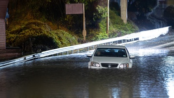
New Zealanders will be facing days of wet weather from Friday as most of the country is set to be struck by two lows currently moving over the Tasman sea.
Cloud were forecast to gradually increase over the country today ahead of a complex low system which would begin moving over the country on Friday with rain expected to continue to Tuesday for some areas.
"There is a very complex system moving over the country this week and into the weekend.
"It will be a bit of a prolonged event," Metservice meteorologist Sarah Haddon said.
MetService said a low moving over the Tasman sea was set to drench the West Coast of the South Island on Friday with moderate confidence that rainfall accumulations would meet warning criteria over northwest Nelson, Westland and northern Fiordland.
"The warning criteria for heavy rain is 50mm in 6 hours, or 100mm in 24 hours.
"There is also low confidence (20 per cent chance) of northeast gales will be severe over southern Westland and northern Fiordland."
Over the North Island, there was moderate confidence, a 40 per cent chance, of significant heavy rain from Taranaki to Tongariro National Park, and low confidence for the Tararua Range.
Over the weekend a new low hanging around the western Tasman Sea was expected to bring rain over parts west of the South Island from Fiordland to Nelson.
"There would be some areas still getting hit by rain until Tuesday.
"There will be bands of rain moving across the country.
"Everyone will get some rain," Haddon said.
Over the North Island there was moderate confidence of significant heavy rain continuing through Saturday and Sunday over the Taranaki to Tongariro area, with low confidence from Northland to Taupo, as the second front moved eastwards.
The Bay of Plenty and the Gisborne ranges had low confidence of significant heavy rain on Saturday, increasing to moderate on Sunday and Monday.
Take your Radio, Podcasts and Music with you