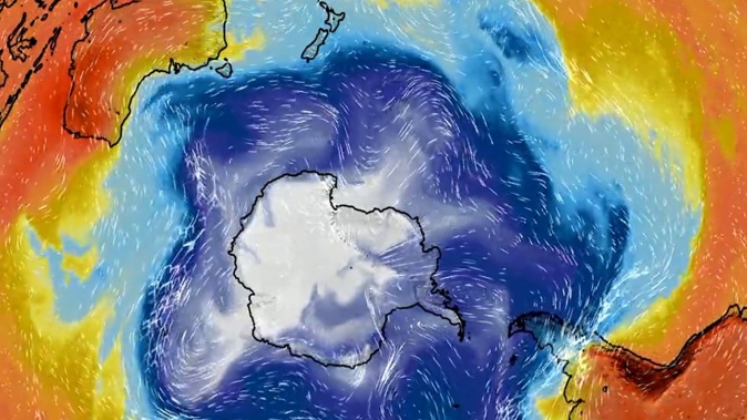
Near record-breaking spring temperatures are set to sizzle parts of the country before a polar blast sees the mercury plunge a chilly 10C in 24 hours.
MetService forecasts Twizel, Wanaka, and Timaru could be some of the warmest spots today, reaching 27C, 26C, and 25C.
Niwa said the warm temperature is a result of an overhead air mass from eastern Australia, which may even bring Aotearoa’s first 30C this spring.
But by Friday the weather is expected to flip to polar opposites in temperatures, thanks to an Antarctic chill.
Within 48 hours, certain areas swing from 6C above average to 6C below, as a sharp southerly change looks set to move up the country on Friday.
MetService meteorologist Thapi Makgabutlane said on Wednesday and Thursday the country will be graced by warm temperatures.
“This will be especially felt in the central and eastern South Island, where today Twizel is expected to get to 28C, and Alexandra and Ashburton could see a maximum of 26C.
“Even Southland is expected to be warm, with places reaching 22C. On Thursday places like Christchurch and Blenheim could reach 28C and 27C in Ashburton.”
A cold front and a sharp temperature will move across the South Island on Thursday and Friday, and eventually reach the North Island on Saturday.
“Maximum temperatures in the South Island on Friday are expected to only reach the low to mid-teens for most places, and some elevated parts of the lower South Island could even get some snow.”
Makgabutlane said Christchurch, Ashburton and Queenstown are only forecast to climb to 13C, while Alexandra gets to a maximum of 14C.
“For the North Island, the strongest change will be seen around Masterton with drops from 24C on Thursday and only 13C on Saturday.
“For the likes of Auckland and Northland that have been feeling that warm and humid ‘tropical-like’ weather these last few days, this cold front will also bring a change to cooler and fresher air on Saturday.”
Makgabutlane noted this kind of weather system is not all that unusual for late spring.
“Apart from a change in temperatures, this cold front also brings rain, and the eastern stretches of both the North and South Island are where the bulk of that rain is expected.
“It also brings strong winds for the lower and eastern North Island as a strong southerly push is expected.”
Makgabutlane said there may be watches or warnings issued in the coming days by MetService.
Take your Radio, Podcasts and Music with you


