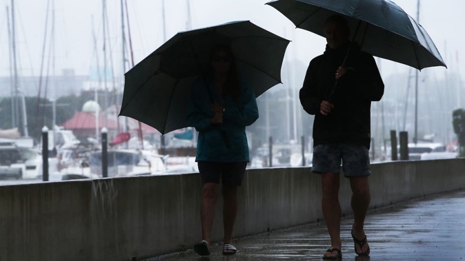
- Thunderstorms and heavy downpours are forecast for the North Island today.
- The South Island faces heavy snow and strong winds.
- Weather warnings and watches have been issued.
Thunderstorms and heavy downpours are tipped for much of the North Island today, as heavy snow and strong winds continue to lash the South Island.
A dynamic low in the Tasman Sea, featuring a “moisture-rich” cloud band that extends from near Darwin in Australia to New Zealand, is delivering widespread rain and wind this week, forecaster Niwa says.
“Blocking high pressure to the south and north means that the system will be slow-moving with lots of rain and elevation snow,” Niwa said.
MetService meteorologist Mmathapelo Makgabutlane said it was looking like a wet day ahead for the North Island on Wednesday, beginning with thunderstorms for the upper regions.
“Up north we’re expecting those thunderstorms to be a feature for the bulk of the day,” Makgabutlane said.
For lower parts of the North Island, she said a “very average winter’s day” was expected, featuring icy cold southerly winds and wet weather.
Thunderstorms tipped for the North Island
Fronts moving over the country were expected to bring unstable conditions to several areas in the North Island and northern South Island during this morning, bringing a possibility of developing thunderstorms, MetService said.
There is a moderate risk of thunderstorms before dawn for western Waikato, Waitomo, Taumarunui and northern Taranaki.
“[These thunderstorms] may bring localised heavy rain with intensities of 15-25mm per hour, and there is also a low risk of localised downpours producing rainfall rates of 25-40mm per hour.”
There was also a moderate risk of thunderstorms for Coromandel Peninsula, coastal Bay of Plenty and the far north of Tairāwhiti/Gisborne before dawn, as well as for the far north of Northland in the late morning.
 The North Island is tipped for thunderstorms on Wednesday morning. Photo / MetService
In the afternoon and evening, there was a moderate risk of thunderstorms for Northland, Auckland and Coromandel Peninsula. Heavy rain of 10-20mm per hour could fall in some areas.
MetService earlier said while rain is on the cards for much of the country this week, the wettest weather was expected in the east of both the North and the South Islands.
“This is a developing situation, and although it’s all happening in the South Island during the early part of the week, it’ll be a good idea for people in the eastern North Island to also have a close eye on the forecast,” Makgabutlane said.
Severe weather warnings, watches for South Island
A raft of weather warnings and watches have been issued throughout the South Island, including a yellow heavy rain watch over Canterbury Plains from Christchurch northwards and eastern Marlborough as well as south of Christchurch, which came into effect at 2pm yesterday.
The MetService forecast is for periods of heavy rain through to 3pm today and rain was expected to turn to snow above 300m. Amounts may approach warning criteria.
Snow is another constant in the South Island today, with 25-35cm of snow expected to settle above 400m for the North Canterbury high country and the foothills north of the Rangitata River. There was a moderate chance this would upgrade to a red warning before it lapsed at 4pm this afternoon.
 South Island highways were closed yesterday and alpine areas were blanketed in snow. Photo / Sharlene McKinley
“Prepare for snow, cold temperatures, and possible power outages. If you must travel, drive cautiously, and ensure you have snow chains, sleeping bags, warm clothing, and emergency items,” MetService said.
Fresh road snowfall warnings were issued yesterday for motorists using Lewis Pass (SH7), Arthur’s Pass (SH73), Porters Pass (SH73), Lindis Pass (SH8), Crown Range Road and Dunedin to Waitati Highway (SH1).
These warnings would lapse throughout Wednesday up until 11pm. Between 40cm and 60cm of snow was expected to settle on SH73, with the larger totals at higher elevations. Motorists were urged to take care.
“This is expected to be a wide-reaching snow event, especially for farmers and road users,” Makgabutlane said.
MetService meteorologist Ngaire Wotherspoon told the Herald snowfall could continue after the weather warnings and watches lapse.
“It’s quite a complicated weather situation right now,” Wotherspoon said.
“We do expect those freezing levels to keep dropping and the snow to keep falling.”
Niwa said snow would continue in the South Island into Thursday.
Meanwhile, severe gales gusting up to 130km/h are also expected for Westland and Grey districts today, with the potential to damage trees, powerlines and unsecured structures. The strong wind warning was scheduled to lapse at 1pm today.
A further strong wind warning over Fiordland was due to conclude at 8am today.
Take your Radio, Podcasts and Music with you


