The clouds are forecast to clear to see the stars of Matariki this Friday, but not before a few areas across the country continue to have some more wet weather.
Tonight, the last bit of the rain will hang on in Northland, with thunderstorms possibly bringing localised heavy falls of 10 to 20 mm/h.
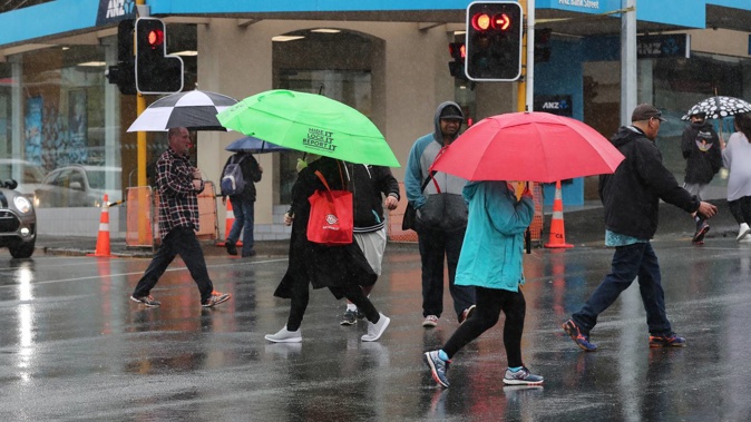
As the weather system that caused many weather warnings today along the east coast moves away, another system from the west is poised to take its place, bringing a fresh batch of showers along the west coast.
The wet weather is forecast to miss Auckland and, after a wet start to the school holidays, it is predicted to be an excellent week to get the kids outside to stretch their legs.
From Monday through to Wednesday, according to MetService, the days will be mostly fine with only the odd isolated shower in the evening.
The weather may start to pack up again for a brief period on Thursday afternoon, with possible heavy showers and strong westerlies. However, these will clear for Matariki celebrations on Friday.
Across the rest of the country, Tuesday sees a low-pressure area near the Chatham Islands slowly move away to the east, clearing the way for a wet west-to-southwest flow to develop, with embedded fronts and troughs moving quickly through New Zealand.
There is a low probability of severe west or southwest gales for Central Hawke’s Bay, the Tararua district, the southeast of Southland, including Stewart Island, and eastern Otago during this time.
This flow strengthens over central and southern New Zealand for a while on Wednesday and Thursday.
Additionally, there is little likelihood that Nelson will experience significant southwest gales on Thursday.
The temperatures are set to remain typical for July this week.
Even if it doesn’t significantly raise temperatures, eastern regions will welcome the return of at least a little sunshine because Christchurch and Wellington have both had exactly zero sunshine hours this weekend.
For those planning to make the most of the winter holidays and hit the slopes, snow is expected on Tuesday and Wednesday in the mountains around the Southern Lakes.
Further north, snow is expected on Wednesday and Thursday in Tongariro National Park, which will help beef up the snow base on Mt Ruapehu.
The upper slopes at Whakapapa received 6cm of snow over the last week, with Turoa’s upper and lower slopes both receiving 10cm in that time, Mt Ruapehu’s website said. More is expected in the coming week.
Take your Radio, Podcasts and Music with you


