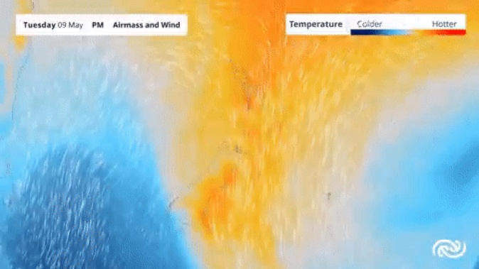
More heavy rain is on its way to the country’s West Coast this week, as well as a likely bout of snow for some parts of the South Island.
The rain band which brought heavy rain to Nelson, Tasman and Marlborough on Saturday moved south onto the West Coast on Sunday, where it will stay for a couple of days, MetService said.
A heavy rain warning is in place for the northern and western parts of the South Island as a moist northerly airstream is forecast to bring heavy rain through to Tuesday.
Heavy rain will also affect northern and western parts of the North Island from Tuesday.
“On Tuesday this rain band is going to reintensify and move back eastwards and across the country again bringing another burst of heavy rain to northern and western parts of both islands. These are areas which have already seen heavy rain this past week,” MetService meteorologist Jessie Owen said.
A colder southerly outbreak is forecast to move over New Zealand on Wednesday and Thursday, which will likely bring snow to inland parts of the South Island.
MetService said it’s currently forecasting snow to 500m but it’s still early days.
“Cold southerlies are expected to spread up the South Island on Wednesday and the North Island on Thursday. This will bring snow down to about 4-500m over the South Island, and finally drop temperatures back down again,” Owens said.
“At the moment we are still sitting under a stream of warm, moist air from the tropics – the same weather feature that has been affecting the country for most of the week.
This means overnight temperatures are set to remain in the muggy mid-high teens for most for a few more days.
“The reason this stream of tropical moisture has hung around for so long is because of a large high-pressure system to the east of us which is blocking it from moving past.
“On Tuesday we will see it finally moving away but unfortunately it does take require another weather system to force this to happen, so this is not quite the end of the unsettled weather,” Owen said.
North Island minimum temperatures will remain in the mid-high teens until midweek and then drop down to single digits by Thursday with even the possibility of some morning frost in central areas by the end of the week.
Maximum daytime temperatures will also drop by about 5-8 degrees.
For the South Island overnight tempratures will go from mid-teens to low single digits by the end of the week with the likelihood of frosts.
Take your Radio, Podcasts and Music with you


