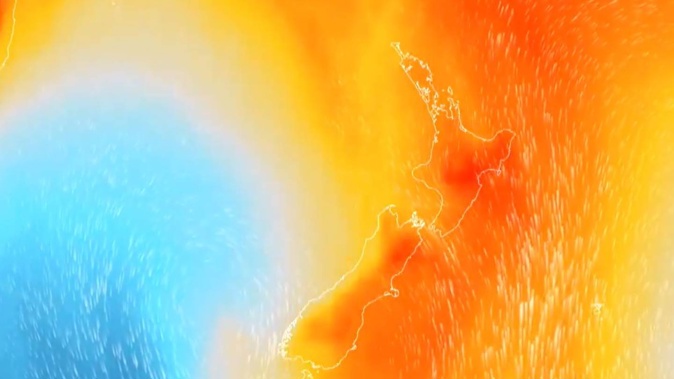
It’s set to be a wet, windy and warm day across the country as “fingers of tropical moisture” touch down.
MetService has issued heavy rain watches for Northland, northern Auckland, Great Barrier Island, the Coromandel Peninsula and Bay of Plenty west of Tauranga. Rainfall may reach warning levels in these areas.
A strong wind watch is also in effect for Auckland, about and north of Whangaparaoa.
Easterly winds may approach severe gales in exposed places from 6pm, gusting 90km/h from evening.
The weather is more settled in other parts of the country, with Christchurch in for patchy drizzle and Wellington in for a mostly cloudy day.
Warmer, humid air from the tropics has made a beeline for the country.
Niwa said after a rather cool start to summer many parts of New Zealand would be sweltering in wet, muggy conditions.
“Fingers of tropical moisture are commonly expected to reach down and touch New Zealand in the coming week,” tweeted the forecaster.
For most of the North Island, humidity levels are expected to sit between 75 per cent and 97 per cent depending on the region.
In Auckland the humidity levels for today are expected be up at 97 per cent while in Hamilton they could reach 91 per cent. In the South Island the levels are at 96 per cent for Timaru and 93 per cent for Westport.
- 'Fingers of tropical moisture': Wet weather bears down
- Bad weather rolls into new week with a forecast of showers, heavy rain and thunder
MetService meteorologist Jessie Owen that most of the country’s temperatures are gradually rising and by the end of the week they would sit at mid to high 20s with some areas on the eastern coast of the North Island, including Napier, getting up to around 28C.
The hottest areas on the North Island today will be Kaitaia and Whangarei, reaching 22C and 21C respectively. Auckland, New Plymouth and Palmerston North are not far behind and are expected to reach highs of 20C.
In the South Island, Invercargill is also forecast to reach 22C while Christchurch and Dunedin are expected to get up to 18C.
MetService meteorologist Lewis Ferris reported that the unsettled weather looks to be hanging around until the weekend.
“It is going to be a relatively active weekend, especially on Saturday with this low pressure gradually moving across the country,” said Ferris.
A high-pressure weather system approaching the country will make for a finer day on Sunday however, but this nice weather will not stick around for long.
By Tuesday warmer air will be dragged across the country again bringing with it more muggy, windy and wet conditions.
“It is going to sit still and it is going to be that humid air and it also is going to bring with it some rain as well, getting quite muggy towards the end of next week,” said Ferris.
Niwa reported that belts of humid weather are going to be more common this summer because of an ocean-atmosphere phenomenon called La Nina.
Traditionally, La Nina has delivered more northeasterly winds, which bring rain to the North Island’s northeast, and drier conditions to the south and southwest of the South Island.
Thanks to the northeasterly winds, warmer temperatures also tended to play out over much of the country during La Nina, although there are always regional and seasonal exceptions.
Niwa said La Niña is creating warm seas in the southwest Pacific, which are causing rising air and storms.
This is the third time that New Zealand has seen a La Nina summer in as many years, dubbed by meteorologists as a “triple dip” – which has only been observed from 1973 to 1975, and most recently from 1998 to 2000.
Take your Radio, Podcasts and Music with you


