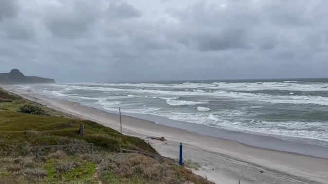
A number of weather warnings have been issued for parts of the North Island as heavy rain and strong winds are forecast to hit.
MetService has upgraded several weather watches to warnings in Auckland, the Coromandel, western Bay of Plenty and Tasman regions while other areas now have weather watches in place.
They come as a subtropical low weather system sits over the Tasman Sea - directing a strong and moist northeast flow over New Zealand.
The weather agency said as a result, some areas will likely receive “warning amounts” of rain and possible severe gale north-easterlies.
“Heavy rain could cause slips, surface flooding and damage to roads. Severe gales could make driving conditions hazardous, especially motorcycles and high sided vehicles,” MetService said.
“Trees may be toppled and powerlines damaged. Temporary structures such as tents could be affected.”
Strong wind warning in Auckland
A strong wind orange warning has been issued in Auckland - including Great Barrier Island - effective from now until 3am tomorrow.
People are being advised of “severe gale” north-easterlies gusting up to 110km/h in exposed places of the city.
Such high winds usually see warnings for motorists on the Auckland Harbour Bridge.
Heavy rain warnings
The weather authority has also issued heavy rain warnings for Northland, Coromandel Peninsula, Bay of Plenty west of Matatā and Tasman northwest of Motueka.
- Earl's Paradise Camp owner: Subtropical storm forces people out of campgrounds in Northland and the Coromandel
- Unhappy campers flee: Concert cancelled ahead of onslaught of subtropical storm
The bad weather conditions far north have already resulted in campers leaving their summer beachside holiday at one Far North campground, as strong winds started damaging tents and gazebos yesterday.
Northland locals are advised that the rain warning is in place for the 14 hours between 9am and 11pm tomorrow.
“Expect a further 70mm to 90mm of rain to accumulate on top of what has already fallen, mainly in the north and east,” MetService said.
The peak rates of between 10mm to 20mm/h can be expected from this afternoon.
/cloudfront-ap-southeast-2.images.arcpublishing.com/nzme/LCF6ZU7NBJFDFHDLTRVNMGKFQE.JPG)
Those in the Coromandel Peninsula should prepare for between 100mm to 150mm of rain to accumulate about about the ranges and lesser amounts nearer the coast.
Peak rates of between 10mm to 20mm/h are expected - particularly from tomorrow morning.
People in the Bay of Plenty, west of Matatā, have a heavy rain warning effective from 9pm tonight until 3am on Friday - a total of 30 hours.
Up to 180mm of rain is expected to fall inland, especially in the Kaimai Range, and lesser amounts of rainfall nearer the coast.
Locals are advised that peak rates of 10mm to 20mm/h are to be expected about the ranges from tomorrow evening.
While in Tasman, northwest of Motueka, a heavy rain warning is in place from midnight tonight until 6am on Friday.
“Expect 120 to 180mm/h of rain about the ranges, with lesser amounts nearer the coast.”
Other parts of the country have been issued weather watches.
Heavy rain watches are in place in the ranges of Westland, south of Otirā, Auckland including the Great Barrier Island, Mt Taranaki, the Richmond and Bryant ranges - including the Rai Valley - and the Marlborough Sounds.
A strong wind watch has been issued in Northland until 1am tomorrow; as well as the Waikato, Coromandel and western Bay of Plenty to Taranaki and Taihape.
Banks Peninsula also has a strong wind watch in place, where northeasterlies may approach severe gales in exposed places, from 4pm today to 10pm tomorrow.
Take your Radio, Podcasts and Music with you


