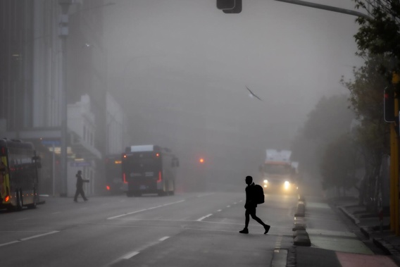
Forecasters say there is a chance more fog could blanket Auckland and Hamilton on Tuesday after Auckland Airport was forced to put flight restrictions in place this morning.
More than five dozen flights were cancelled and delayed out of Auckland Airport this morning after thick fog descended on the city overnight.
MetService meteorologist Fulong Lu told the Herald that from midnight to 7am on Tuesday there was a 30% chance of fog predicted by the Auckland International Airport weather station.
The risk would stretch across the rest of the city, he said.
Lu said the risk was higher for Hamilton Airport, where clearer skies and lighter winds were forecast.

Thick fog blanketed Auckland this morning. Photo / Michael Craig
Just after 10am today, 31 domestic regional flights had been cancelled and 25 domestic regional flights delayed at Auckland Airport.
Nine flights on the main trunk had been affected by the fog, including NZ671 to Dunedin.
Conditions at the airport didn’t clear until later in the morning and no international flights were affected.
The fog spread right across the city, with one commuter describing the conditions in West Auckland as “pea soup”.
Another said the very thick fog in the central city was “treacherous”.
Flight restrictions were put in place at the airport just before 2am.
Around 7am, the fog was “pretty thick”, with only about 200m of visibility, MetService meteorologist Alec Holden said.
By midday the fog had lifted, allowing the airport to resume normal functions.
Fog also affected Hamilton and other areas of the Waikato as well as Taumarunui and Te Kūiti.
MetService earlier had forecast areas of morning low cloud and fog for Auckland, followed by the odd afternoon shower.
The temperature was just under 11C in Auckland early today but reached a high of 19C.
Almost 100,000 lightning strikes recorded over weekend
This morning’s fog came after severe thunderstorms wreaked havoc over much of the country at the weekend.
“Around 93,400 lightning strikes were recorded from midnight on Friday to 6am on Monday, with around a quarter of those occurring over land. Rain intensities peaked at 15mm/h for most affected regions, with some areas seeing 20 to 25mm/h,” said MetService meteorologist Alwyn Bakker.
“However, once the majority of the thunderstorms cleared on Sunday morning the weather improved significantly for much of the country, with temperatures reaching the high teens to low twenties in both main islands.”
Bakker said the unsettled weather was set to continue to start the new week, with strong northwesterly winds expected about central and southern parts of the country and fronts bringing a burst of heavy rain to many western areas.
“We advise people to keep up to date with the latest forecasts, as spring weather is notoriously changeable.
“Thunderstorms are also possible for parts of the South Island, and also coastal Taranaki to northern Wellington on Tuesday,” Bakker said.
There would also be a notable change in temperatures on Wednesday and Thursday, especially in eastern areas.
“Looking further ahead, a ridge over the Tasman Sea starts to extend over New Zealand on Wednesday, driving away most of the poor weather and lowering overnight temperatures. Frosts will be possible in parts of the South Island and inland North Island, along with snow for higher passes.
“Make the most of any settled weather this week as another bout of wind and rain is lined up for the weekend.”
Take your Radio, Podcasts and Music with you


