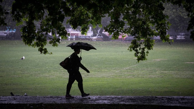
Forecasters warn sodden areas across the North and South Islands are in line for another burst of rain this week bringing a fresh threat of flooding and slips as the wet weather reinvigorates and boomerangs back on to the country.
Snow is also expected to fall in the South Island as temperatures are set to plummet for much of New Zealand in coming days.
MetService meteorologist Andrew James said the rain band currently pouring down on Westland will start to move eastwards tomorrow, bringing more rain to areas including Auckland, Coromandel and Bay of Plenty.
“That front crosses Aotearoa once more [and] moves over the country, going back to the east, bringing another burst of heavy rain to those already sodden northern and western areas,” said James.
“All of those areas that have already had significant rainfall [are] in the line for some more.”
Orange heavy rain warnings have been issued for Auckland, Northland, Coromandel, Mt Taranaki, Tasman, Grey and Westland Districts, Fiordland and for the headwaters of the Canterbury lakes and rivers about and south of Arthur’s Pass.
The warnings for the South Island are already in force and come to an end throughout the day tomorrow.
The warnings for the North Island come into effect tomorrow and MetService is warning that the areas should expect some “squally” thunderstorms.
Auckland’s warning is in place between midday and midnight on Tuesday.
“Around 50 to 70mm [of rain] is expected, but possibly more in localised areas. Intensities of 10 to 15mm per hour, but thunderstorms and downpours of 40mm per hour or more are possible in localised areas.”
Aucklanders are being warned to look out for surface flooding, slips and rising rivers and streams and are also advised that driving conditions may become dangerous.
Northland will be under the orange heavy rain warning between 7am and 7pm tomorrow. The area is already under a severe thunderstorm watch through to tomorrow evening.
“Expect 70 to 90mm of rain, with possibly more in localised areas. Intensities of 10 to 20mm per hour, but thunderstorms may produce downpours of 40mm per hour or more in localised areas.”
Mt Taranaki’s warning is in place between 9am and 9pm tomorrow and the area is expected to see up to 150mm of rain.
As the rain leaves mid-week, so will the warm air with temperatures expected to drop for the entire country and snow expected in the South Island.
James said the cold air will be coming up from Antarctica.
“From Wednesday people will notice a decent drop in the temperatures, some strong winds with that system and possibly looking like a bit of snow down south too.”
Christchurch’s temperatures today are forecast at a high of 22C and a low of 15C but by Wednesday it will have a high of 15C and a low of 3C.
Further south, Queenstown can expect to drop to 0C on Thursday and high of just 9C. Today’s temperatures in the holiday hot spot are between 10C and 17C.
James said temperatures will really start to cool down for the North Island on Thursday.
By the end of the week, Auckland is in store for lows between 7C and 9C and highs of 14C and 17C.
It will be even colder in Hamilton, with forecast lows between 0C and 3C and highs between 12C and 16C expected.
Take your Radio, Podcasts and Music with you
Get the iHeart App
Get more of the radio, music and podcasts you love with the FREE iHeart app. Scan the QR code to download now.

Download from the app stores
Stream unlimited music, thousands of radio stations and podcasts all in one app. iHeart is easy to use and all FREE