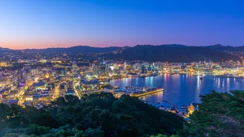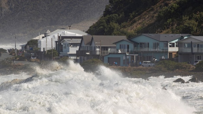
Heavy swells are set to strike the bottom of the North Island tonight, with forecasters predicting waves could rise up to six metres overnight.
It comes as New Zealand grapples with a subantarctic blast, bringing freezing conditions to parts of the country.
An orange heavy swell warning came into effect at 6pm for the Wairarapa from Turakirae Head to Mataikona. It will remain in force until 3pm on Wednesday.
“Heavy swells are expected with southwest combined waves rising to 6 metres Tuesday night, then easing Wednesday afternoon,” the Wellington Region Emergency Management Office (WREMO) said on its social media.
“[The] southerly swell is set to rise to 5 metres Tuesday night, then easing Wednesday afternoon.”
WREMO warned the swells could bring debris and surface flooding to roads, especially around high tide.
Forecaster Niwa said wave heights will likely be greatest very late on Tuesday night and early on Wednesday and warned the period around high tide overnight is worth “keeping an eye on”.
The next high tide for Cape Palliser is at 2.16am on Wednesday morning and 2.29am for Castlepoint.
“If you are planning on being near the coast over the next day or so, do definitely take extra care around that,” said MetService meteorologist Mmathapelo Makgabutlane.
Heavy swells in Cook Strait, meanwhile, have prompted Interislander to cancel all sailings from tonight until Thursday. Bluebridge is also cancelling the 7.45am sailing to Wellington, and the 8.15am to Picton service tomorrow morning.
“All customers affected by these cancellations have been advised by email and text,” Bluebridge said on its website.
Looking ahead to Wednesday, a low pressure system to the east of New Zealand will bring cloudy and showery conditions along the eastern and lower parts of both islands.
“Those southerly winds [in the North Island] will be keeping things a little bit chilly and we could see stronger winds along those coastal areas.”
In Auckland, meanwhile, MetService forecast a partly cloudy morning and chilly start to the day on Wednesday, before sunshine makes an appearance. The city will fall to 9C overnight tonight and rise to a high of 15C on Wednesday.
Wellington has another day of strong southerly winds and showers about the Hutt Valley and eastern suburbs, which will spread elsewhere during the afternoon. A high of 9C is forecast, with a low of 6C.
Fresh southwesterlies have been forecast for Christchurch, where cloudy periods were expected to ease in the afternoon. The Garden City will be mostly cloud with showers tomorrow. It is tipped for a 8C high and a 1C low.
The wintry conditions came as a cold front moved in from the west on Monday, with an area of low pressure crossing the South Island.
“By Tuesday and Wednesday all of New Zealand will be colder – and despite some minor fluctuations, the colder subantarctic air may linger into next week for many places too,” WeatherWatch reported.
While the chilliest weather would hit in the south and east of both islands – directly in the path of the mass as it moved off the Southern Ocean – the website expected to see colder air spread right across the country throughout the week.
Over the rest of winter and beyond, however, Niwa’s three-month outlook has picked near or above-average temperatures in all regions – with fewer winter cold snaps and frosts than normal.
Benjamin Plummer is an Auckland-based reporter who covers breaking news. He has worked for the Herald since 2022.
Take your Radio, Podcasts and Music with you