
Proposed hazard maps for Nelson are allegedly preventing properties across the city from being insured.
The claim has been put to the commissioners overseeing the hearing for the city council’s controversial overhaul of its planning rules.
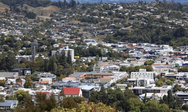
The original maps the council put out for consultation included several areas shaded with flooding, inundation, fault hazard and slope risk overlays.
One Rocks Road resident, whose home falls within the slope risk overlay, said that her property has never failed to be insured until the council put out its map for consultation.
 The Tāhunanui Slump is one area covered by the slope risk overlay and now insurers appear to be retreating from properties in the area. Photo / Nelson City Council
“It has essentially rendered our property uninsurable. This has been incredibly distressing for us as we look to protect our most valuable asset, our home.”
Acknowledging the risks of living on the Tāhunanui Slump – the country’s largest active urban landslide – she said her property underwent significant geotechnical engineering ahead of its redevelopment.
Further independent reports show that the property has remained stable over recent years, despite several severe storms and an earthquake, and will likely continue to do so in the future.
“The council’s approach ... has unfairly painted lots of properties with very different risk profiles with the same broad-brush, which is frustrating, morally wrong and potentially has devastating consequences for the investments we’ve all made into our homes,” she said.
She wants the council’s mapping of natural hazards to take into account the individual risk profiles on a property-by-property basis rather than simply shading an entire area.
“The cost of not doing so is far greater on homeowners and the Nelson region.”
Her property is not the only one affected, developers told the commissioners.
 The Tāhunanui Slump is the country's largest active urban landslide and experience significant movement during the August 2022 storm event which red-stickered several houses in the area. Photo / Max Frethey, LDR
Simon Dobson from Bayview Nelson said he knows of three properties that have struggled to get insurance – two that Bayview has developed and geotechnically engineered inside the overlays and a neighbouring property outside of the Bayview development area and the overlay itself.
He’s also had house sales fall through because buyers have been advised they’d struggle to get properties insured.
“Insurance companies are looking for any excuse to ... reduce their risk, that’s why this information must be accurate,” Dobson said.
Scott Gibbons of GP Investments said the overlays were making buyers “nervous”.
“There’s not a lot of flat land available in Nelson, and to have this blanket approach without detailed information just puts us on the back foot.”
Nelson’s growth would be constrained if the overlays didn’t reflect the geotechnical reality of each individual site, he added.
Resource management lawyer Nigel McFadden was the legal counsel for the developers.
He said the report underpinning the overlays was fundamentally “flawed”.
“What’s happened is ... not only the developers, but the community have had to try to sort out something that was a pig’s ear from day one.”
“The blot that’s created by poorly structured, poorly thought-through provisions and maps has had a major impact,” he said.
“Kick it out, get it done properly.”
 Former mayor Rachel Reese Photo / RNZ / Tracy Neal
Former mayor Rachel Reese thought the plan change had a “chilling effect” on the Nelson market.
“The plan change has had the effect of blighting some properties where it should not have,” she said. “That needs to be addressed.”
The council’s planning experts said that they, and expert submitters, were “pretty close” in alignment on the exact planning rules inside the hazard overlays, and that they were happy to accommodate some of the sought changes, such as changing overlay names to make them less alarming for residents and insurers.
But senior geologist Dan Chamberose said the underlying report was “robust” and had gone through a “significant” review process.
“I believe that it is workable in its current situation, I don’t think kicking it to touch, so to speak, is the right approach,” he said.
“The intent of those overlays is to trigger land where a closer look is required on things that may result in instability. I believe that the provisions that are put in place do manage that.”
He added that the discussion of which properties should be included in the overlay mapping was “complex” but that they were trying to take out those that shouldn’t be included.
Tuesday was the final scheduled day of the hearing for the council’s proposed planning changes, known as Plan Change 29.
The council’s experts will now focus on delivering their final replies to submitters’ evidence by October 31.
The panel of commissioners will then determine whether further sessions or conferencing between experts was needed before deliberating on the proposal.
Once deliberations are concluded, the panel will make its recommendation on the final plan to the council, which will have very limited grounds to reject the recommendation.
“We’ve still got a way to go yet,” panel chair Greg Hill said.
Max Frethey, Local Democracy reporter
LDR is local body journalism co-funded by RNZ and NZ On Air.
Take your Radio, Podcasts and Music with you