Auckland experienced its fifth hottest day on record yesterday while other parts of New Zealand braced for a battering of rain and thunderstorms as a tropical cyclone strengthens near Australia.
The National Institute of Water and Atmospheric Research (Niwa) announced yesterday that Auckland had also notched up its hottest day in four years, reaching 29.7C.
Parts of Wellington also had their hottest day in two years as temperatures in Upper Hutt soared over 28C.
The hottest was Masterton which reached a scorching 33C.
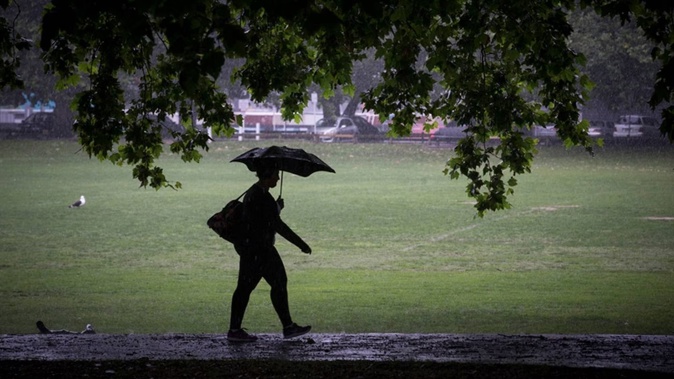
It came as MetService issued a raft of severe weather warnings and watches across both islands, with torrential rain expected to hit Gisborne and Westland overnight and today.
Severe thunderstorm warnings were issued for Hastings, Rangitikei, Kāpiti Coast, Horowhenua, Tararua, Palmerston North, Carterton and Masterton districts throughout yesterday evening but were all lifted.
Severe thunderstorm watches were also in place for Taumarunui, Taupō, Hawke’s Bay, Taranaki, Taihape, Wanganui, Manawatū, Tararua, Kāpiti-Horowhenua, Wairarapa and Wellington until 9pm last night.
An orange heavy rain warning came into effect for Gisborne at 9pm last night with peak rates of 20 to 30mm/h expected this morning.
MetService told residents to expect 125 to 175mm of rain between 9pm last night and 2pm today.
MetService meteorologist Claire O’Connor told the Herald the rain comes from a lower pressure system which is descending on New Zealand from the north.
“Given the way the winds go around, it will direct the rain towards the eastern coast so that’s where those warnings come into play there.”
Further south, a yellow heavy rain watch is also in place for Westland and Grey Districts until midday today, with thunderstorms and localised downpours of 25 to 35mm/h possible.
MetService says further heavy rain is likely tonight and early tomorrow morning, caused by a front moving up from the south.
“There’s a bit of precipitation that will impact the West Coast - but it’s fast moving so it won’t have as much impact as the weather the other day,” O’Connor said.
On Friday the West Coast was under a state of emergency due to torrential rain that caused rivers to rise rapidly and forced the closure of State Highway 6 between Haast and Hokitika.
O’Connor said despite more rain being forecast, it wasn’t all bad news - a much-needed break in the high heat and humidity is also forecast to drift across the country this week.
“With this feature moving up the country, these cooler south-[westerlies] go right across the country flushing out the humidity and the heat as well.”
Overnight temperatures could drop into single digits in the South Island this week and Invercargill is looking at a chilly Wednesday - with a high of 13C forecast.
Further north it’s a similar story with overnight temperatures expected to dip to half of their current temperature.
“The highest [temperature] I can see overnight on Wednesday is 15 degrees,” O’Connor said.
Tropical cyclone strengthening
O’Connor said the tropical cyclone that is strengthening over the Coral Sea is looking like it will hit over the ditch before it makes landfall in New Zealand - if it hits at all.
The cyclone is forecast to hit Australia on Monday, but O’Connor said it is difficult to know whether it will strike New Zealand, and how severe it will be if it does.
“It’s going to hit Australia, particularly Queensland but in terms of for New Zealand, it’s still quite far out that a lot of uncertainty and in the models that we can’t say for sure what impact would be for New Zealand if it did come our way.”
Forecasters are closely tracking potential for a tropical low over the Coral Sea to form into a cyclone system, with Australia’s Bureau of Meteorology currently giving a “high” chance (or 55 per cent) of it reaching cyclone strength by early this week.
Niwa meteorologist Ben Noll said that, among other favourable conditions for cyclone development over coming weeks, surface temperatures in the Coral Sea were running warmer than average.
“Basically, west of New Caledonia, extending all the way to the coast of Queensland, we’re seeing moderate to strong marine heatwave conditions.“
Up in the Coral Sea, meanwhile, the marine heatwave could increase the potential for a formed cyclone system to intensify, while contributing more moisture.
“I’d agree it’s too early to say what we can expect with this one,” Noll said of its implications for New Zealand.
Take your Radio, Podcasts and Music with you