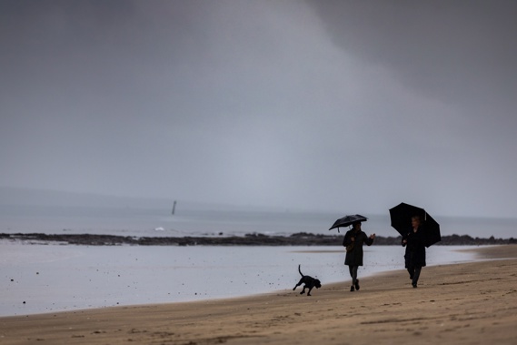
- A weather forecaster is predicting a “cool lean” for much of New Zealand over the first half of January, amid chilly southerly and south-westerly flows
- Wellington is forecast to reach just 14C on Sunday – with 90km/h gusts possible in exposed places – although Aucklanders will get highs in the early 20s for most of next week
- A La Nina climate driver that’d been tipped to deliver warm, wet and muggy conditions to the north-east over late summer now looks increasingly unlikely to form
Where’s summer gone?
That’s a question many beachgoers around New Zealand might be asking themselves right now, after a country-wide shift to cooler, wetter weather over recent days.
And it’s a pattern that Niwa forecaster Chris Brandolino expects to see continue for the first half of January.
“For much of the country, but not all, we’re expecting a cool lean – and that theme will probably persist for another week to 10 days,” Niwa forecaster Chris Brandolino said.
Some places would be particularly feeling those markedly un-summer-like conditions.
Brandolino singled out Wellington, which was experiencing a run of rainy days with highs reaching only the mid-teens – and winds forecast to gust at 90km/h in exposed places on Sunday.
“That’s absolutely atrocious weather for January... that’s laughable.”
Other spots in for a milder end to the weekend include Christchurch, with a forecast high of just 16C on Sunday, along with Dunedin (15C), Taupō (16C) and Gisborne (17C).
On Monday, MetService is forecasting rain in the south and east of the North Island – possibly heavy at times – before easing later in the day, with fine spells and isolated showers elsewhere.
The South Island will see cloudy periods and a few showers in northern and eastern areas, while most other regions remain dry.
Tuesday is forecast to bring clearing showers to the North Island’s east with fine spells across much of the island, but in the South Island, rain is forecast to spread north, with some areas likely to experience heavy falls.
Northern centres including Auckland, Tauranga and Hamilton were likely to see temperatures nudging toward the mid-20s throughout next week – but broadly, there’d still be a difference from December’s “exceptionally warm” weather, Brandolino said.
Most places in the country saw well-above-average temperatures over the first third of summer, he said, “and people seem to forget that”.
“Now people are out on holiday, they’re exposed to the elements and they’re asking, what’s going on?”
The main culprit was dominant southerly and south-westerly flows from below New Zealand.
Those winds had also helped churn up the sea surface around New Zealand’s coasts – and dissipating marine heatwave conditions that were driving up air temperatures just a few weeks ago.
“At any rate, the west of the South Island may be one place, certainly over the next couple of weeks, where it’s good for holiday-makers – that means not a lot of rain and temperatures that are pleasantly warm, particularly for that part of the world.”
For all of New Zealand, he said a spell of more typical summer weather was possible for mid-January.
“We may start to see at least a brief reprieve, even if only for a couple of days, of settled, dry, warm weather for much of the country.”
Amid the picture, Brandolino said there were also signs of expanding dryness across the upper North Island, which could “intensify” over the rest of summer.
But at the same time, a wetter shift from months of dry and relentless westerly winds in Hawke’s Bay had begun to alleviate drought conditions there.
Further in the background, the long-anticipated arrival of a La Nina climate pattern – which had been expected to bring warm, wet and muggy conditions to the north-east over late summer – now looked increasingly unlikely.
“I’m doubtful that we’ll see any sustained La Nina-like weather patterns in the coming weeks and months,” he said, citing unusual warmth in the waters off South America as a potential factor disrupting the big driver’s formation.
“We may see flashes of it. We may see periods of it. But, for that key word sustained, I think the window is shutting.”
Australia’s Bureau of Meteorology similarly reports sea surface temperatures in the central tropical Pacific will remain in the current “ENSO-neutral” range through to April, despite dropping close to the La Nina threshold this month.
Niwa is set to release its climate outlook for the first three months of 2025 next week.
Jamie Morton is a specialist in science and environmental reporting. He joined the Herald in 2011 and writes about everything from conservation and climate change to natural hazards and new technology.
Take your Radio, Podcasts and Music with you


