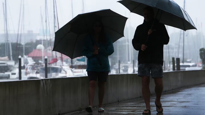
- Parts of the country are off to a wet start, with thunderstorms, and hail forecast for Monday
- Cooler temperatures are expected in places, with some areas forecast for highs about 5-7C lower than the average for this time of year
- A mix of rain and sun is forecast throughout the week, with sunny days on Wednesday and Thursday
School students may want to break out their raincoats when heading back to school in the morning, with parts of country expecting rain, thunderstorms, and hail.
The first week back at school for the term is a mixed bag weather-wise, in line with usual spring conditions, MetService forecaster Gerard Bellam said.
It’s much of the same for many, whose school holidays opened with widespread showery weather and risks of thunderstorms.
Monday morning is starting off with some cooler-than-average temperatures in parts of the country, including frosty, sub-zero temperatures in places like Invercargill and Gore.
“Unfortunately there’s a low-pressure system on Monday, it looks quite wet with showers over central and northern parts of Aotearoa New Zealand,” Bellam said.

Hail may hit parts of the North Island on Monday. File photo / Michael Cunningham
“We’ve also got the risk of some thunderstorms around, especially over inland parts of the North Island and Northland.”
Inland from Manawatū to Waikato, as well as Northland, may be in line for thunderstorms and hail, with rainfall expected to be about 10-20mm per hour.
Despite the forecasted hail, the temperatures in these areas are not expected to be too low on Monday, though further south Kiwis may want to throw on an extra layer.
Bellam said Wellington was only expected to have a high of 10C tomorrow, while the average for this time of year is 15C.
He said a southerly flow in the northern part of the South Island was also bringing wet conditions and lower temperatures - for example, Kaikōura was forecast to have a high of 11C, about 4 degrees lower than the average.
“It’s not a great morning to be trudging off to school,” Bellam said.
Further south it will be chillier, but likely fine.
“We are seeing a cold front invade Southland with the cold change coming in in the evening.”
But heading into Tuesday a cold southerly low will start pulling away to the east of the North Island.
As various systems move around the country, most New Zealanders can expect a combination of rain and sun through the week, with the sunniest days forecasted to be Wednesday in the South Island and Thursday in the North Island.
“Things are quite mobile at the moment, quite spring-like conditions.”
Monday’s temperature forecast:
Auckland: Low 10C, high 16C
Tauranga: Low 11C, high 17C
Hamilton: Low 7C, high 16C
Wellington: Low 7C, high 10C
Christchurch: Low 2C, high 13C
Dunedin: Low 3C, high 14C
Take your Radio, Podcasts and Music with you


