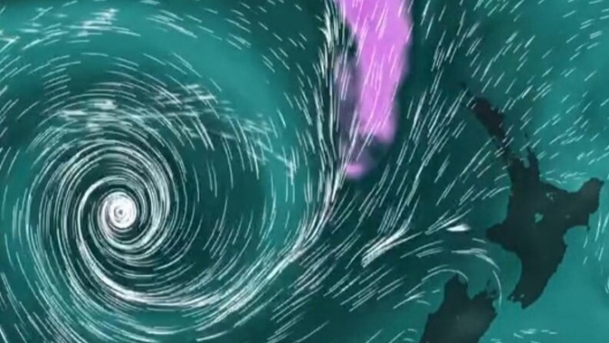
- Atmospheric river bringing rain to both North and South islands later this week.
- Rain not enough to bust drought already affecting Northland, Auckland, Waikato, Horizons, Marlborough-Tasman, and Taranaki, expert says.
- Warm overnight temperatures are also expected for many parts of the country this week.
A river of rain nearing the country is “one of the more promising” wet weather systems seen in a while, but is unlikely to be a droughtbuster, experts say.
It would take 30mm of rain falling each day over three days out of the week to bring “meaningful change” in drought conditions, Niwa’s Chris Brandolino said ahead of the weather system’s expected arrival.
“[That’s what] is really needed to get pasture growth and pasture recovery of any significant volume”.
Forecasters are warning a large weather system is likely to bring the “atmospheric river” to New Zealand this week, with rain expected in the South Island from late Wednesday or early Thursday, and the North Island a day later.
It’s set to be “one of the more promising” rain-bearing systems seen in a while amid “dire” ongoing drought conditions throughout the North Island, MetService meteorologist Mmathapelo Makgabutlane said.
MetService recorded parts of Northland, Auckland, Bay of Plenty and Waikato had received less than half the typical March rainfall.
“It would seem that March is carrying the baton, continuing the legacy of a dry 2025 so far,” Makgabutlane said.
But much-needed rainfall is expected in the second half of the week, with a large weather system approaching from the Tasman Sea ”one of the more promising rain-bearing weather systems we have seen in a while”.
A drought has been declared in Northland, Waikato, Horizons, Marlborough-Tasman, and Taranaki regions, with farmers buying extra feed and sending stock to greener pastures to give their paddocks a respite.
Meanwhile, Watercare’s drought management plan was activated last month after ongoing dry weather pushed the levels of the Auckland region’s dams down.
Settled weather would dominate the start of the week — except for the odd shower for some spots — but Wednesday into Thursday would mark a shift to wetter conditions nationally.
“Western and northern parts of both the North and South islands may see heavy rain, while strong northerly winds are also possible, particularly for the North Island,” Makgabutlane said.
“Whether the rain and wind arrive late Wednesday or Thursday, the second half of the week will be the one to watch.”
Western parts of the North Island had been relying on spotty showers that had only brought patchy rainfall, but this system looked to bring more widespread wet weather, she said.
“It will take more than this one system to make a meaningful difference to the current dry situation. However, it is a step in the right direction.”
Forecaster Niwa said low pressure over the Tasman would bring an atmospheric river south from the tropics.
Meanwhile, warm, humid nights are also tipped for later this week as a moist northerly airflow covers the country.
MetService said overnight temperatures in the mid-to-high-teens could be expected for many — a drastic change from recent single-digit temperatures that had brought frost to some areas.
“Auckland can expect night-time lows of around 18C for most of this week, while Christchurch will only drop to 15C on Friday morning — its warmest overnight temperature in over a month,” the forecaster said.
“The last time much of the country saw overnight temperatures this warm was mid-February, with a similar system from the Tasman Sea. The result will be very different feeling weather compared to the cold fronts from the southwest that have been the norm recently.”
Take your Radio, Podcasts and Music with you


