First warnings have been issued of potentially destructive winds and heavy rain and possible flooding set to slam into the top of the North Island this weekend.
Strong wind warnings are due to come into force on Sunday morning along with two heavy rain warnings and a rain watch for Northland, Auckland and Coromandel.
The eastern and northern coastline is also set to be pummelled by monster 6m waves as king tides combine with strong onshore winds.
MetService says Lola, which has now been downgraded to a tropical low, was due to merge with another low-pressure system north of New Zealand.
The new storm is set to unleash its fury from 9am on Sunday.
MetService warns severe gusts of up to 130km/h will hammer Northland for up to 20 hours. It warns the gusts could damage trees, powerlines and unsecured structures and pose a hazard to motorists.
The rain will start falling before midday and MetService warns of the risk that evening thunderstorms could cause flash flooding and slips.
Bay of Islands Coastguard has already issued an alert to boaties warning them to be aware of the deteriorating conditions and to keep abreast of weather alerts across the weekend.
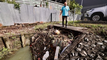
Northland Civil Defence today advised those at the top of the country to prepare properties ahead of the approaching storm by clearing gutters and drains, securing outdoor furniture and structures and making sure people had enough supplies if the region was hit by power cuts or road closures.
The worst of the weather is set to strike Auckland in the evening with severe gales hitting from 6pm and lasting through the night.
- Tropical cyclone remnants set to strike NZ; freezing temperatures tipped
- Drenching from remnants of Lola to take over from wintry hammering
Potentially damaging gusts of up to 130km/h are expected to hammer the region including Great Barrier Island.
Rain is also forecast to fall for 15 hours non-stop overnight. At this stage only a heavy rain watch has been issued.
MetService said two low-pressure systems north of New Zealand were poised to merge on Sunday off the Northland coastline bringing heavy rain and strong winds to the northern and eastern regions of the North Island.
Strong winds, heavy rain and huge swells are forecast to ravage areas from Northland to East Cape on Sunday and Monday before a week of rain plagues the top of the north.
Forecaster John Law said there would be severe gales and heavy rain for the top of the country and Bay of Plenty, Waikato, Gisborne, and Hawke’s Bay from Sunday evening through Monday.
At this stage warnings and watches have not been issued for eastern regions.
Niwa said the remnants of Cyclone Lola would interact with a different weather system to produce a separate low over the northern Tasman Sea.
Ocean swells about the Bay of Plenty, Northland and elsewhere could bring wave heights of up to 6m on Monday.
Independent forecaster WeatherWatch said what was left of Lola would create a “squash zone” of gale northeasterlies which could threaten power cuts and bring down trees.
“Due to the nature of the large high-pressure zone to the south, along with the low to the north, there will likely be a fine line between rain and dry weather - which means forecasts and risk areas may still change a bit in the coming days,” WeatherWatch said.
Take your Radio, Podcasts and Music with you


