A deep subtropical low likely to be classed as a “weather bomb” will brush past the North Island, with MetService issuing heavy rain watches for both islands on the last weekend of school holidays.
The fast-moving low will drag heavy rain across Northland, north Auckland, Coromandel and Tasman, where watches are in place from tomorrow night.
After Canterbury climate analyst James Morrison tweeted that the Global Forecast System model showed a pressure drop of 28 hectopascals (hPa) in 24 hours for the low, private weather forecaster WeatherWatch replied: “If this occurs, the media have permission to use the term “Weather bomb!”.
The development of the low was likely to be classed as an explosive cyclogenesis, MetService meteorologist Mmathapelo Makgabutlane said.
An explosive cyclogenesis - also known colloquially as a “weather bomb” - is when a low develops very quickly, often associated with intense weather near it.
However, the impact depended on where it developed, and at this stage the low looked to be remaining well offshore, Makgabutlane said.
“It’s only the rain on its outer edge that looks to brush over the North Island.”
The extent of the rain would depend on the east or westward movement of the low, she said.
“So it will pay to keep an eye on the forecast over the next few days as things develop. We will continue to monitor its development and issue any severe weather information as necessary.”
The worst of the weather was expected in parts of the upper North and South islands from tomorrow night, with rain steadily worsening in the northern North Island as the day goes on.
“As [tomorrow] continues the rest of the North Island can also expect a little bit of that rain starting to drift down. And in the western South Island as well.
“But for the lower and eastern South Island, it looks like it should be continuing to remain fairly dry.”
A 12-hour MetService heavy rain watch for Tasman, west of Motueka, begins at 7pm tomorrow.
The watch was for periods of heavy rain, with possible thunderstorms.
“Rainfall amounts may approach warning criteria, especially about the ranges. [And there’s a] moderate chance of upgrading to a warning.”
There was also a moderate chance a heavy rain watch for Northland and Auckland north of Whangaparāoa Peninsula would be switched up to warning. The 12-hour watch begins at 9pm tomorrow.
A 13-hour heavy rain watch was also in place for Coromandel Peninsula from 8pm tomorrow, but this had low chance of being upgraded to a warning.
No watches or warnings have been issued for eastern Bay of Plenty and Gisborne Tairāwhiti, but they could also expect wet weather tomorrow and Saturday, Makgabutlane said.
“It looks like, at some stage, most parts of the North Island can expect some wet weather.”
However, those in the north wouldn’t need to wrap up, with mild temperatures expected.

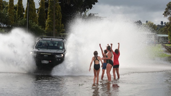
Pack your brolly, but no need to wrap up in the north - it will be wet, but mild for those heading outdoors this weekend. Photo / Brett Phibbs
The forecast high in Auckland on Saturday was 17C, a couple of degrees above average for July, Makgabutlane said.
“This weather system is drawing in air from the north, which is much warmer than air from the south.”
Meanwhile, parents keen to get housebound kids outside have a short window on Sunday.
“The first part of Sunday is looking probably the best of the day, for most places [and] into the afternoon. Then we’ve got the next weather feature that starts to move across the latter part of Sunday.
“It looks like it will be bringing a return of some showery weather, especially for the North Island and parts of the South Island.”
Cherie Howie is an Auckland-based reporter who joined the Herald in 2011. She has been a journalist for more than 20 years and specialises in general news and features.
Take your Radio, Podcasts and Music with you


