Forecasting agencies have called time on the El Nino of 2023-24. So what can Kiwis expect from the winter ahead of us? Jamie Morton reports.
El Nino is over. What does that mean?
It was the first El Nino we’d experienced in nearly a decade - but according to Australia’s Bureau of Meteorology, it’s officially now over.
The big climate driver and its classic pressure set-up around New Zealand has been largely responsible for relentless westerly wind over the better part of a year.
It’s also made for some milder days: it had a clear hand in what was our coolest month in six years last August and also our coldest March in 12 years.
Another of its calling cards has been dryness in eastern regions, where, after months of little rain and parching westerlies, fire officials are still warning of potential for flare-ups.
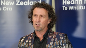
Niwa meteorologist Chris Brandolino said the 2023-24 event would go down as a standout for several factors.
It was a late bloomer, with its clearest impacts here coming months after its summer peak.
It also played out against a backdrop of climate change and - unusually - local marine heatwaves and lingering warmth in the West Pacific, which has sourced the odd subtropical rain-maker.
What can we expect from winter?
While ocean conditions in the equatorial Pacific have shifted back to “ENSO-neutral”, El Nino still isn’t quite done with us.
Brandolino likened the transition in our ocean-atmosphere state to slowly dialling down a light dimmer, rather than flicking an off switch.
- El Niño threat looms large over tourism this summer
- El Nino weather expected to draw more sharks, scientist says
- Coming 'La Nina-like' pulse could prove big rainmaker for NZ
“The atmosphere isn’t always aligned with the ocean, so there may be a bit more of a lag with this El Nino flavour to our weather, as we work our way through the rest of autumn and into winter,” he said.
“That could mean more of those westerly-type winds and dryness persisting a bit longer in some areas.”
The New Zealand Drought Index showed dryness persisting across most of the North Island’s east coast, along with Marlborough and coastal Canterbury.

Source / NIWA
Across the North Island, Brandolino said current guidance showed few strong signals for above-normal rainfall in these areas over the next three months.
“Those are areas we’ll have to watch now. Late autumn and winter is the time of year when we get that ground-water recharge that replenishes the moisture lost in summer.
“If we don’t get that, if puts people in a corner where they need rain in spring ahead of the next warm season.”
As El Nino-like patterns gave way to more of a neutral regime in winter, it was likely there’d be more variability in the season’s weather.
“You don’t know who’s got their hands on the steering wheel of Mother Nature’s car - so without the lack of a distinct climate driver, it does make [forecasting] a bit more challenging,” Brandolino said.
Still, a colder-than-average winter appeared unlikely, with sea temperatures predicted to be average to above average for coming months.
“That certainly makes it more challenging to get any sustained periods of cold air and may delay that seasonal transition to winter.”
What about later in 2024?
Brandolino pointed to another potential development that could help kill some of the chill in spring: the return of La Nina.
The US National Oceanic and Atmospheric Administration has put the odds of La Nina forming this year - which would remarkably make for this decade’s fourth event - at 85 per cent.
Whether that happened wasn’t guaranteed, given the notorious uncertainty in climate models at this time of year.
“If La Nina were to develop - and if it developed a bit more rapidly than what’s expected - then that could encourage more flows from a northerly direction [over spring],” Brandolino said.
“That’s obviously not good news if you’re a skier, or if you’re in the snow business.”
But it didn’t mean Kiwis could expect an extremely wet, warm and wild summer like 2023′s - which was fuelled, along with climate change, by ocean heat piled up over three years of La Nina.
“The amount of heat that was built up in the West Pacific really can’t be overstated,” Brandolino said.
“So, if we do get a La Nina, that won’t guarantee we get the same results.”
Jamie Morton is a specialist in science and environmental reporting. He joined the Herald in 2011 and writes about everything from conservation and climate change to natural hazards and new technology.
Take your Radio, Podcasts and Music with you


