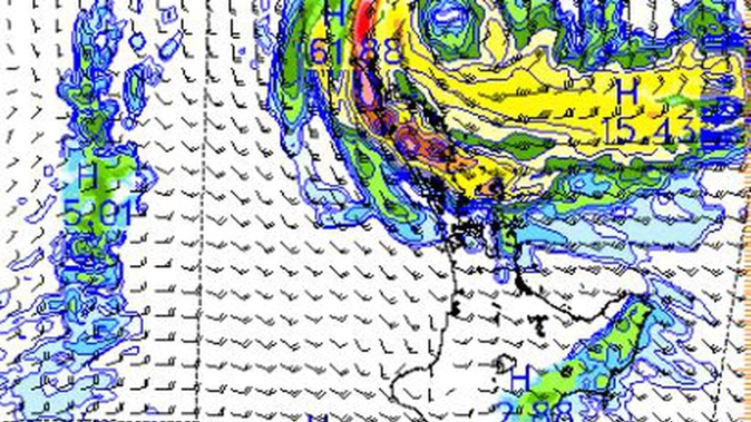
Heavy rain is set to inundate popular northern holiday hotspots this Easter holiday weekend with a jetstream-powered rainmaker spinning towards New Zealand today.
MetService has forecasted gales and downpours for Northland, northern parts of Auckland, Coromandel and Waikato from Friday through Saturday, with a risk of thunderstorms.
The national forecaster issued a heavy rain watch for Northland from 6pm on Thursday to Friday morning, saying: “The impacts could be significant if [the rain] eventuates.”
And it was set to remain intermittently miserable for much of the country throughout the school holidays.
MetService meteorologist Dan Corrigan warned holidaymakers to follow forecasts closely as current predictions about the subtropical low’s movements were uncertain.
“We do know to a reasonable degree places are ... likely to see some severe weather. The low-pressure system is evolving as it gets closer to us. It’s good to keep an eye on it because the forecast is likely to change as we hone in on it.
“When we get a large amount of rain in a small amount of time, that can put a lot of stress on the land. We [could] see slips that can cause road closures,” Corrigan said.
Rivers could swell after rain fell in higher areas, and driving could become dangerous with risks of surface flooding.
“There may well be a risk of thunderstorms with this at the moment, [but] thunderstorms are one of those things where you can forecast areas where there is a risk but it’s difficult to say exactly where [they] will pop up.
“It’s certainly a ‘watch this space’ sort of thing. We get some of our heaviest rain intensities with thunderstorms so they can definitely have an impact, for sure.”
Hauraki Gulf Weather said the subtropical low started to spin off the Australian coast and towards New Zealand today.
“Embedded lightning on the developing frontal boundary. It will head due east today towards Norfolk Island, consolidating multiple circulation centres to become [a] large jet stream-powered system on Thursday,” the forecaster said.
The heavy rain should skip Auckland City, Corrigan said, but could hit Gisborne and Manawatū as the rotation of the storm brought southerly gales up the middle of the island.
The Manawatū Gorge would squeeze the air as it flowed through, “like if you have a hose and you [make] the opening smaller, it squirts out quicker. It’s similar to the atmosphere because the air behaves as a fluid.”
The South Island, meanwhile, is forecast to have fine, settled weather for the first half of the weekend before souring as the low moves down the country.
“From Sunday and Monday, our low is tracking away towards the southeast and then it’s replaced by a strong sort of northerly/northwesterly flow. And that will bring more periods of rain,” Corrigan said.
“It’ll be mostly intermittent for much of the country. It depends on who you are and what your plans are [to say the school holidays are ruined].”
Take your Radio, Podcasts and Music with you


