Flood protection in Hawke’s Bay cannot solely rely on stopbanks and more room should be made for swollen rivers to spread out and spill into, the last Cyclone Gabrielle flood review to be released insists.
The latest major review into the Cyclone Gabrielle floods which tore through Hawke’s Bay on February 14 2023 was released on Wednesday.
That 250-page report known as the Hawke’s Bay Independent Flood Review was commissioned by the Hawke’s Bay Regional Council to investigate what caused the floods and also to review the regional council’s flood management schemes.
Hawke’s Bay has 249km of stopbanks and deflection banks. During the floods, over 5km of the regional council’s stopbank network breached across about 30 locations, and a further 28km were weakened.
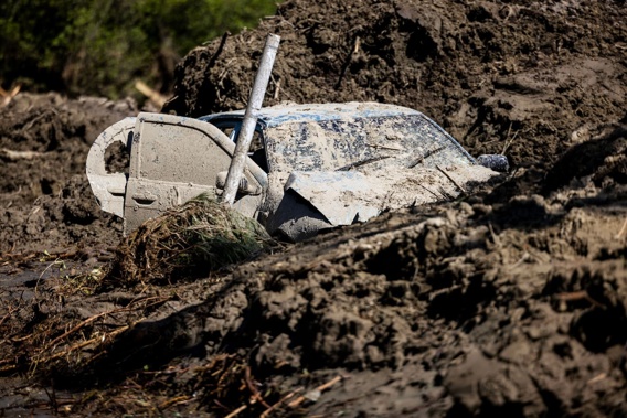
Eight people died in Hawke’s Bay during and following the cyclone and the floods caused about $5 billion of damage and losses to the region.
The review put forward 47 recommendations including for the council to consider the “evolving global best practice” of “making room for the river”, to function alongside stopbank protection.
“For example, secondary systems including spillways, diversions and storage areas should be considered with the objective of directing floodwater to identified areas with the lowest consequences to the communities of Hawke’s Bay,” the report read.
That would allow “floodwaters to spill, flow and be stored in a controlled manner” in the case of extreme floods including when stopbanks fail.
The report did not recommend whether the council would need to purchase land to make room for those spillways or identify exactly where the spillways and storage areas should go.
However, the report stated that without “making room for the river” it could lead to a “completely impractical evacuation scenario” in future, where around 100,000 people would need to be evacuated around the Heretaunga Plains (wider Napier and Hastings area) in the case of another extreme flood being forecast.
- Study shows low health risk from Cyclone Gabrielle silt
- 'I'll believe it when I see it': Residents doubt action will follow Cyclone Gabrielle report
- Cyclone review: Hawke's Bay Civil Defence staff told those concerned about flooding they were 'over-reacting'
Trigger level needed for alerts
The report noted that Hawke’s Bay Regional Council alone was not in charge of making decisions for evacuations during Cyclone Gabrielle, which was the responsibility of Civil Defence.
However, the regional council did have the responsibility of providing timely advice and information to Civil Defence about the worsening weather, including from its many weather stations.
The report criticised the regional council for its communication with Civil Defence (CDEM) during the lead-up to the floods.
“The language used in communications to CDEM was not as clear and decisive as it could have been.
“This may have affected the decision-making of territorial authorities and Civil Defence in terms of issuing warnings and initiating evacuations at risk areas.”
The report noted terms like “worst case scenario” in emails should be avoided, which featured in some communication to Civil Defence, as it may convey an “overly optimistic assessment of what may actually occur”.

The cyclone caused about $5 billion of damage to Hawke's Bay. Photo / Mike Scott
A recommendation to improve that communication in future was to have clear “trigger levels” at various rivers, which could help Civil Defence make evacuation decisions.
“It is noted that the council’s Flood Response Manual (2015) has no information on evacuation trigger levels for any of the rivers within the region.
“From reviewing the timeline and communications logs evacuation warnings appeared to be fairly ad-hoc during Cyclone Gabrielle,” the report read.
“HBRC should identify specific trigger levels for alerts and recommended evacuations for known flood risk areas, document them in its Flood [Response] Manual and communicate them to those who are affected.”
The regional council told the review panel that “rather than trigger points being pre-set, the trigger for providing evacuation advice has been the expert assessment of HBRC’s flood forecasters”.
“That assessment is based on flood modelling, MetService forecasts, antecedent conditions, the observed levels of rivers, etc,” the regional council stated, in the report, adding that was consistent with most other regional councils.
Significant challenges faced in the cyclone included MetService rainfall forecasts being well below what actually eventuated, and telemetry from dozens of regional council rainfall and water level monitoring sites failing during Cyclone Gabrielle.
‘Lessons from the past have not been learnt’
The report questioned why relatively new housing had been allowed to go ahead in the likes of Tangoio and Esk Valley, despite large floods hitting those areas during the past 100 years.
Both those areas were badly flooded again in the cyclone, with Esk Valley suffering perhaps the most devastation of any community in Hawke’s Bay.
“The fact that there were relatively new housing developments in areas of known flood risk suggests that lessons from the past have not been learnt and development has been allowed in high-hazard areas,” the report read.
“Flood risk has been underestimated in some areas due to a lack of accounting for large historic flood events, the Esk Valley and Tangoio Beach being particularly relevant examples.”
The report referenced the 1938 Esk Valley flood, the 1963 Tangoio flood, and flooding in Pōrangahau in 1941 and 1953, the latter of which was also an example “of significant historic floods not being accounted for”.
The report recommended the regional council should “urgently review” the Regional Policy Statement to include “clear and directive objectives and policies” regarding land use management in flood hazard areas.
The review agreed with the regional council’s Category 3 zoning decisions for Esk Valley and Tangoio.
Regional council responds
HBRC chair Hinewai Ormsby welcomed the report and said it was an emotional moment for the council.
“As Hawke’s Bay and indeed New Zealand works out how to deal with the effects of climate change and more intense storms, learning from our recent experiences is critical.
“The review has identified a range of important learnings and provides valuable recommendations.
”What all the reviews have told us is that the way we have worked for the past 30 years can’t be the way we work for the next 30 years.
“That journey has already begun and there is a massive amount of work ahead.”
The independent review was led by a three-person panel including environmental planner Phil Mitchell (chair), river engineer Kyle Christensen, and barrister Bernadette Arapere.
The full report can be found on the regional council website.
Gary Hamilton-Irvine is a Hawke’s Bay-based reporter who covers a range of news topics including business, councils, breaking news and cyclone recovery. He formerly worked at News Corp Australia.
Take your Radio, Podcasts and Music with you


