Last week, experts warned climate change added 10% more rainfall to ex-tropical Cyclone Gabrielle, with an 80% chance of a similar-sized event within the next 50 years. Jamie Morton talks to scientists trying to model what a direct hit on Auckland would look like.
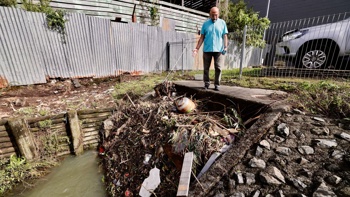
Chris Hung couldn’t quite believe what he saw unfolding outside his front door.
His home, in Greenlane’s leafy Karetu Rd, supposedly sat high enough to have been safe in a one-in-100-year Auckland flood event.
Instead, on the evening of January 27 last year, he found water from that evening’s torrential rainstorm filling his street and rising quickly in his driveway.
He and his wife scrambled to save their Steinway grand piano and harp - a priceless gift from her father - before the floodwater began gushing in.
He and a neighbour struggled in the rain and darkness to force open a blocked manhole, but the damage had already been done.
Some properties were inundated with up to a metre of water. His own home’s ground floor had to be completely restored, with flood damage to every room but the kitchen.
“It was a scary night,” he said, adding that he’d never seen so much rain drop on Auckland in such a short amount of time.
Nor had meteorologists.
At Albert Park, a few minutes’ drive away, a weather station registered a whopping 211mm - three times Auckland’s normal rainfall for January - within just six hours.
- Global warming intensified Cyclone Gabrielle - Niwa
- Cyclone review: Hawke's Bay Civil Defence staff told those concerned about flooding they were 'over-reacting'
- One year on, we remember them: The 11 people who died in Cyclone Gabrielle
- East Coast lost 10 meters of shoreline from Cyclone Gabrielle
Niwa didn’t consider that Auckland Anniversary Weekend storm, and the city’s wettest day, a one-in-100-year event, but at least a one-in-200 year one.
It was the result of a low-pressure system, loaded with subtropical moisture, moving slowly over central Auckland.
Forecasters have described several freak factors of the storm, like a long band of squeezed thunderstorms and a ribbon of strong wind that glided just over the city, that made it so devastating.
Then came Gabrielle.
The ex-tropical cyclone might have ruined many more homes in Auckland, particularly in landslide-hit spots like Piha and Muriwai, but the city was largely spared the blow copped by the likes of Eskdale and Wairoa.
That raised the question: what if the next Gabrielle struck Auckland as squarely as the January 27 storm had?
“Auckland has had a number of near-misses,” Professor Richard Flay said, “and the question is not if we will have a direct hit, but when”.
What would a 2050 cyclone look like?
The University of Auckland engineer is among a team of scientists, working under the Resilience to Nature’s Challenges programme, who’ve been trying to understand what such an event would look like.
There are plenty of reasons why that’s such a critical question to answer.
Auckland is home to hundreds of billions of dollars’ worth of property, along with a third of the country’s population and nearly 40% of its GDP.

The January 27, 2023 storm caused widespread landslides across Auckland - including these in Massey's Colwill Rd. Photo / Brett Phibbs
Last year’s storms were enough to cause several billion dollars worth of damage, in public buy-outs and private insurance claims, to hundreds of homes like Hung’s.
And the risk of more deluges like 2023 is only growing.
Last week, Niwa scientists announced climate change had added about 10% more rainfall to Gabrielle, while Treasury officials reported 80% odds of an event like that recurring within the next 50 years.
Depending on how hard the world goes in tackling climate change, cyclones themselves could become 10% to 26% more damaging by century’s end.
It’s also increasingly possible, as ocean waters slowly warm, that cyclone systems which track southward to New Zealand could retain the tropical characteristics which make them so catastrophic in the Pacific.
Those features include their famous “eye-wall vortices” - tornado-like winds that spin within the most intense part of the systems – and strong bands that feed in rain and moisture.
It’s long been notoriously difficult for scientists to predict how these giant atmospheric heat engines will behave in a warmer world, decades from today.

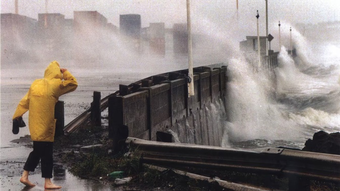
Auckland's waterfront, pictured during cyclone Lusi on March 15, 2014. Photo / Michael Craig
But that’s quickly changing, thanks to computational advances enabling scientists to down-scale global models to area blocks of just a few hundred metres.
Here in New Zealand, it’s meant they can explore hypothetical super-storms in the future – such as a 2050 cyclone slamming straight into Auckland.
In some exposed hill-top areas, their simulations show, winds could reach peak gust speeds of around 200km/h - about twice the strength of winds that blasted Auckland during Gabrielle.
Flay said winds that furious could drive flooding in low-lying areas like Tāmaki Dr, rip cladding from buildings, topple high-side vehicles, knock over cellphone towers and blow trees onto power lines.
Ships in the Waitematā Harbour could break from their moorings and drift down to strike the Auckland Harbour Bridge, potentially putting it out of action for months.
Niwa meteorologist Richard Turner said insights from the modelling had already been used to inform wind speed thresholds for closing the bridge, which is now shut when gusts reach 90km/h to 100km/h.

Auckland Harbour Bridge was closed for weeks in September 2020 when a freak 127km/h gust knocked over this NZ Van Lines truck and another. It's now closed when gusts reach 90km/h to 100km/h. Image / Graeme_Kiwi via Twitter
The team has also been using the University of Auckland’s wind tunnel to simulate the effects of cyclone-strength gales flowing through the city.
So far, that’s shown how channels between the CBD’s high-rise buildings could act like funnels that’d increase a cyclone’s wind power.
As for how much rain that 2050 event could dump, Turner said scenarios had pointed to an event total of 128mm, but that was based on a “limited” number of studies, and likely an underestimate.
If a system rolled across Auckland slowly enough, as the record rainfall of the January 27 deluge showed, it had the potential to unleash much more.
Preparing for disaster
The scientists told the Herald their work would be important for making Auckland’s roads and buildings more storm-resilient – whether against landslides, extreme waves or wind.
Flay figured it’d also help address another “critical point of failure” - moving people efficiently and out of harm’s way.
He saw that problem himself in May last year, when city traffic slowed to a gridlock for hours after officials called a local state of emergency.
“I live on the North Shore and fortunately was able to get across the harbour from work at Newmarket by ferry before they stopped running.”
Among the many other lessons from the recent big storms that agencies have taken onboard was the need for clearer weather forecasting information.
GNS Science social scientist Dr Sally Potter and colleagues have since been exploring the idea of “impact-based” weather warnings focused on how people would be affected themselves.
But that wasn’t easy to do.
“Forecasters have to balance describing generic impacts that might affect most people, such as ‘potential impacts to transport’, with more meaningful and specific impacts like ‘expect the Kāpiti Line train service to be cancelled at rush hour’,” Potter said.
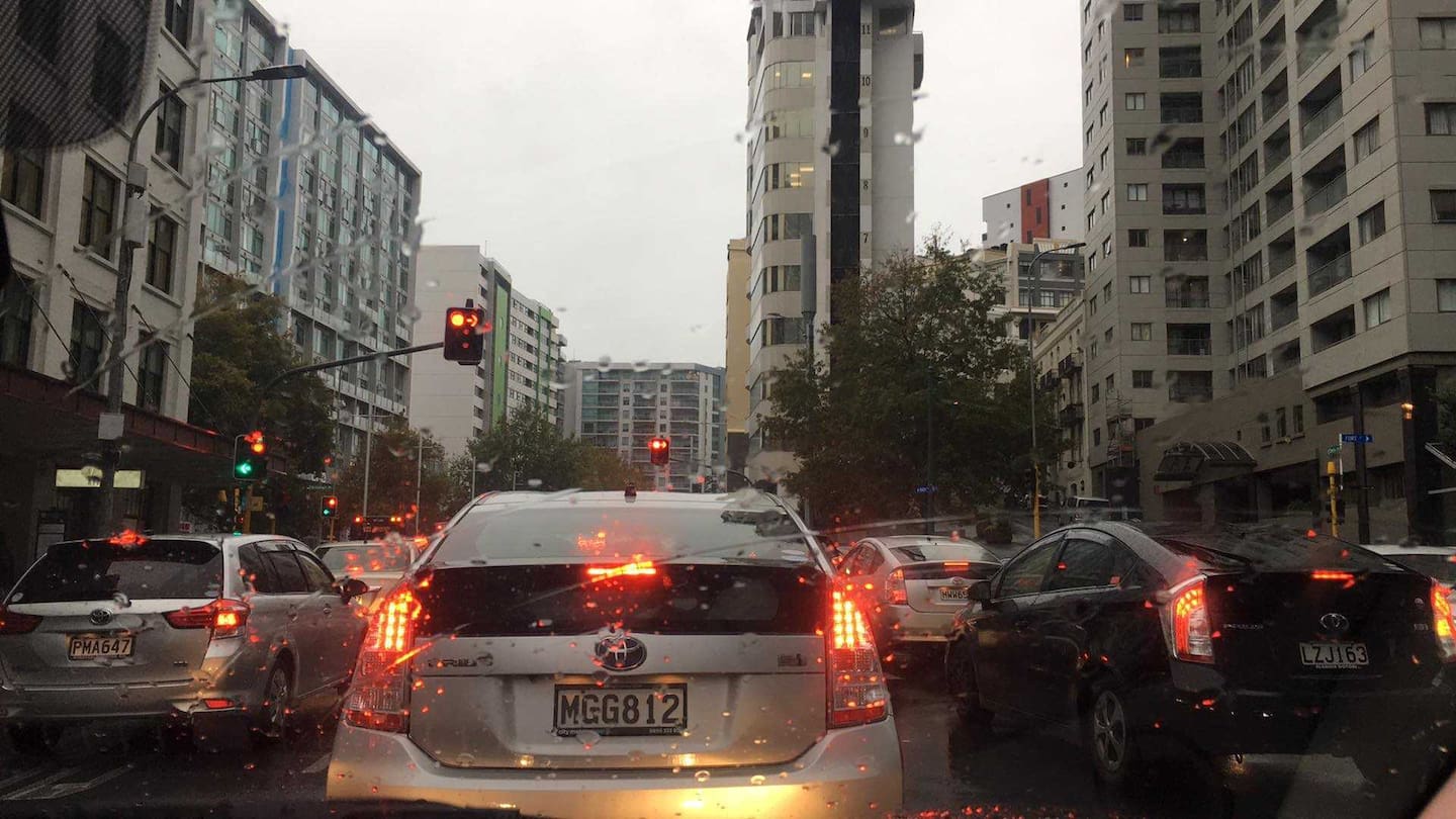
Soon after another state of emergency was called on May 9 last year, Auckland traffic slowed to a gridlock. Photo / David Williams
“It’s simply not yet possible to be forecasting the impacts in real time at this level of detail across New Zealand, but our scientists are working on it.”
Eventually, though, it might be possible to send personalised warnings alerting people that their roads might be soon cut off, or that their usual travel routes might be disrupted.
“There are a lot of issues to navigate, including privacy, and I suspect that tech giants who hold a lot of that data will move down this path faster than our official government agencies.”
Right now, Potter added, it was still vital to tell people steps they could take to protect themselves before a storm hit.
For its part, Auckland Council has overhauled its emergency response planning and repaired and improved its infrastructure in the wake of last year’s storms.
Auckland Transport has also made plans to ensure it provides faster, real-time alerts about road conditions in future emergencies, and now has better planning for opening alternate public transport and road access.
But that didn’t change the fact that some 50,000 city properties which lay in the path of overland flow paths and flood plains could be affected by another one-in-100-year storm.
In Greenlane, Hung and neighbours have learned their own lesson: and have a contingency plan for the next deluge.
For others, he has some simple advice.
“People need to be prepared.”
Jamie Morton is a specialist in science and environmental reporting. He joined the Herald in 2011 and writes about everything from conservation and climate change to natural hazards and new technology.
Sign up to The Daily H, a free newsletter curated by our editors and delivered straight to your inbox every weekday.
Take your Radio, Podcasts and Music with you