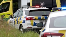
“People first,” was the thought from Dannevirke campground manager Karl Thompson.
The stream which runs behind the holiday park was rising fast.
“We didn’t know how high it was going to come.”
Normally around a metre deep, within a short time it was six times that and he had to make a call to evacuate.
There were visitors from all over - people from the South Island, some from Northland and even some from as far away as Germany and the Netherlands.
“Some were a long way from home,” Thompson said.
Many had been stranded due to roads being closed or made unsafe because of flooding.
For some areas in Dannevirke, it just seemed to be a typical bad day, having escaped the brunt of Cyclone Gabrielle, with far less rain falling in the township than in coastal areas.
However, overflowing rivers fed into the streams, causing slips and flooding and cutting off communities.
By 7pm Tuesday evening, Thompson decided to evacuate the campground in the interests of people’s safety.
- Cyclone Gabrielle: Tararua state of emergency declared
- Cyclone Gabrielle: Red-stickered home in Coromandel falls off foundation
- Kieran McAnulty warns people to take Cyclone Gabrielle seriously, despite downgrade
- Thames Coromandel District Council CEO describes Gabrielle's impact as 'carnage'
He said setting a calm tone around the evacuation helped to ensure everyone else remained calm.
Around 40 people went to the Civil Defence shelter set up at the Dannevirke Sports Centre in Anderson Street where they could get food and other assistance from the volunteers from Ngāti Kahungunu ki Tāmaki nui-a-Rua.
The campground was reopened on Wednesday but the rest of the Tararua District was still counting the cost in the aftermath of the cyclone.
Coastal communities, including Akitio, Owahanga and Herbertville were the worst hit on Tuesday with slips and flooding.
Weber Road was flooded when the Manawatu river overflowed, blocking off a large area around Waitahora.
Tararua District mayor Tracey Collis declared a state of emergency for the district on the advice of Civil Defence early on Tuesday morning. The district was later included in the national state of emergency.
Collis said she was pleased with this as it would make it easier to get assistance.
Teams were sent out to evacuate those in the worst-hit areas who had chosen not to self-evacuate on Monday and others were out doing their best to clear the roads from fallen trees and other debris.
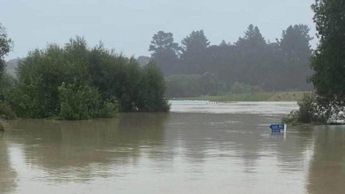
The Herbertville campground was flooded on Tuesday but the waters receded after a few hours.
/cloudfront-ap-southeast-2.images.arcpublishing.com/nzme/OEKX6XP2JVGK5OFFRE2DH2M5FI.jpg)
The campground in Herbertville was flooded. Photo / Facebook
There was surface flooding on some of the roads around Dannevirke as of Tuesday morning and by evening, campers at Dannevirke campground were forced to evacuate.
/cloudfront-ap-southeast-2.images.arcpublishing.com/nzme/6WGNSYQ76ZCPFNLBZM2OBBUZCM.jpg)
Christian Street, by Dannevirke Domain had a bit of flooding Tuesday morning. Photo / Leanne Warr
/cloudfront-ap-southeast-2.images.arcpublishing.com/nzme/SRGORDZ26JBRDHDPFG6MYNRJ4U.jpg)
The intersection of New and Miller Streets also had some flooding. Photo / Leanne Warr
The council asked residents not to travel unless “absolutely essential” with warnings of slips and flooding and that advisory continued into Wednesday.
One resident in Pongaroa warned people not to drive along Route 52, roughly 6km from the village due to flooding.
/cloudfront-ap-southeast-2.images.arcpublishing.com/nzme/6UE5YDSMLRCTXDP5T5LH6EJAVM.jpg)
Flooding on Route 52 near Pongaroa village. Photo / Rebecca Eastwood
There were power outages reported by Scanpower, in several areas and the council was asking residents to conserve water due to the pressure on Dannevirke’s wastewater and water treatment plants.
A spokesman from the council said it would be days, weeks and years before roads would return to normal.
“Bridges have been damaged and there are large slips and washouts throughout the district.”
He said teams were assessing damage and planning the clean-up of the district.
Many roads remained closed and some were expected to be for some time yet.
Take your Radio, Podcasts and Music with you


